File:Copmanthorpe station site geograph-3154611-by-Ben-Brooksbank.jpg
Jump to navigation
Jump to search

Size of this preview: 800 × 486 pixels. Other resolutions: 320 × 195 pixels | 640 × 389 pixels | 1,024 × 623 pixels | 1,280 × 778 pixels | 2,393 × 1,455 pixels.
Original file (2,393 × 1,455 pixels, file size: 3.43 MB, MIME type: image/jpeg)
Captions
Captions
Add a one-line explanation of what this file represents
Summary
[edit]
| Description |
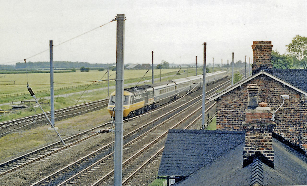
English: Site of Copmanthorpe station, with Up High Speed Train, 1988. View southward, on the ex-NER main lines to York etc. from Church Fenton, the two furthest tracks - with an HST on the Down - from Sheffield/Normanton/Wakefield/Manchester via Burton Salmon, also since 10/73 from Doncaster and the South by the ECML; the two nearest tracks are the lines from Leeds and Manchester. Copmanthorpe station was closed to passengers from 5/1/59, to goods from 4/5/64. |
| Date | |
| Source | From geograph.org.uk |
| Author | Ben Brooksbank |
| Permission (Reusing this file) |
Creative Commons Attribution Share-alike license 2.0 |
| Attribution (required by the license) | Ben Brooksbank / Site of Copmanthorpe station, with Up High Speed Train, 1988 / |
| Camera location | | View this and other nearby images on: OpenStreetMap |
|---|
Licensing
[edit]

|
This image was taken from the Geograph project collection. See this photograph's page on the Geograph website for the photographer's contact details. The copyright on this image is owned by Ben Brooksbank and is licensed for reuse under the Creative Commons Attribution-ShareAlike 2.0 license.
|
This file is licensed under the Creative Commons Attribution-Share Alike 2.0 Generic license.
Attribution: Ben Brooksbank
- You are free:
- to share – to copy, distribute and transmit the work
- to remix – to adapt the work
- Under the following conditions:
- attribution – You must give appropriate credit, provide a link to the license, and indicate if changes were made. You may do so in any reasonable manner, but not in any way that suggests the licensor endorses you or your use.
- share alike – If you remix, transform, or build upon the material, you must distribute your contributions under the same or compatible license as the original.
File history
Click on a date/time to view the file as it appeared at that time.
| Date/Time | Thumbnail | Dimensions | User | Comment | |
|---|---|---|---|---|---|
| current | 10:02, 7 October 2012 | | 2,393 × 1,455 (3.43 MB) | Chevin (talk | contribs) | == {{int:filedesc}} == {{Information |Description={{en|1='''Site of Copmanthorpe station, with Up High Speed Train, 1988.'''<br/> View southward, on the ex-NER main lines to York etc. from Church Fenton, the two furthest tracks - with an HST on the Dow... |
You cannot overwrite this file.
File usage on Commons
The following 2 pages use this file:
File usage on other wikis
The following other wikis use this file:
- Usage on en.wikipedia.org
- Usage on www.wikidata.org