File:Coordillera del Amambay - panoramio.jpg
Jump to navigation
Jump to search

Size of this preview: 800 × 245 pixels. Other resolutions: 320 × 98 pixels | 640 × 196 pixels | 1,024 × 314 pixels | 1,280 × 392 pixels | 2,560 × 785 pixels | 9,905 × 3,037 pixels.
Original file (9,905 × 3,037 pixels, file size: 15.4 MB, MIME type: image/jpeg)
Captions
Captions
Add a one-line explanation of what this file represents
Summary
[edit]
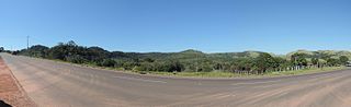
| Description | Coordillera del Amambay | ||
| Date | Taken on 1 August 2014 | ||
| Source | https://web.archive.org/web/20161029134221/http://www.panoramio.com/photo/109977305 | ||
| Author | Rodney Damián | ||
| Permission (Reusing this file) |
This file is licensed under the Creative Commons Attribution-Share Alike 3.0 Unported license. Attribution: Rodney Damián
|
||
| Panoramio Tags | Amambay Department, Departamento Amambay, Paraguay |
| Camera location | | View this and other nearby images on: OpenStreetMap |
|---|
File history
Click on a date/time to view the file as it appeared at that time.
| Date/Time | Thumbnail | Dimensions | User | Comment | |
|---|---|---|---|---|---|
| current | 11:40, 5 May 2017 | 9,905 × 3,037 (15.4 MB) | Panoramio upload bot (talk | contribs) | == {{int:filedesc}} == {{Information |description=Coordillera del Amambay |date={{Taken on|2014-08-01}} |source=http://www.panoramio.com/photo/109977305 |author=[http://www.panoramio.com/user/7668598?with_photo_id=109977305 Rodney Damián] |permission=... |
You cannot overwrite this file.
File usage on Commons
There are no pages that use this file.