File:Cook Island - Southern Thule.svg
Jump to navigation
Jump to search

Size of this PNG preview of this SVG file: 452 × 600 pixels. Other resolutions: 181 × 240 pixels | 362 × 480 pixels | 579 × 768 pixels | 772 × 1,024 pixels | 1,544 × 2,048 pixels | 980 × 1,300 pixels.
Original file (SVG file, nominally 980 × 1,300 pixels, file size: 31 KB)
Captions
Captions
Add a one-line explanation of what this file represents
Summary
[edit]
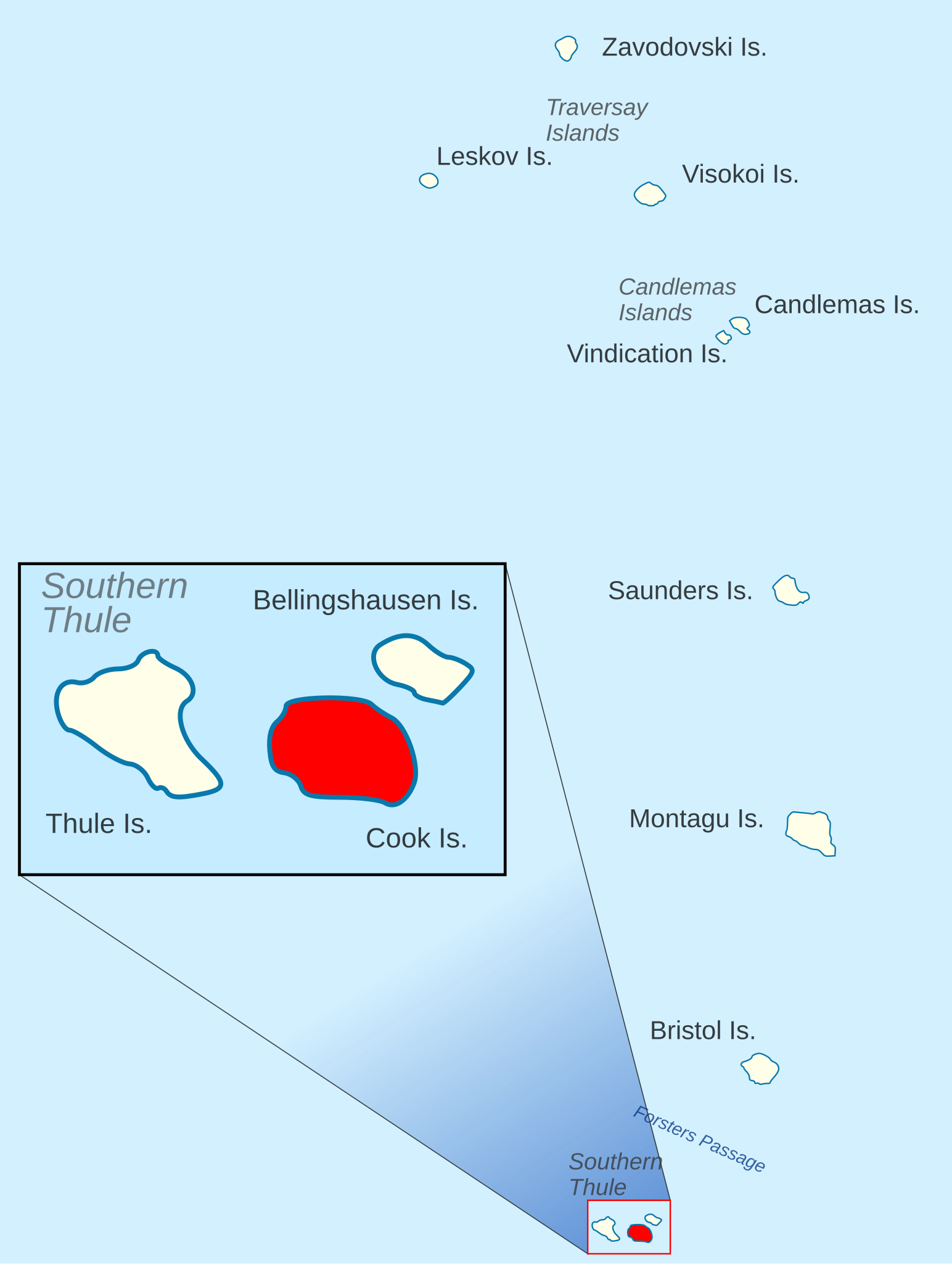
| Description | Location of Cook Island in the Southern Thule Islands of the South Sandwich Islands |
| Date | |
| Source | Bellingshausen Island - South Sandwich Islands.svg |
| Author | Hogweard |
| Permission (Reusing this file) |
This file is licensed under the Creative Commons Attribution 1.0 Generic license. Attribution: South Georgia GIS
|
File history
Click on a date/time to view the file as it appeared at that time.
| Date/Time | Thumbnail | Dimensions | User | Comment | |
|---|---|---|---|---|---|
| current | 15:48, 7 June 2020 | | 980 × 1,300 (31 KB) | Hogweard (talk | contribs) | Aesthetic |
| 15:44, 7 June 2020 |  | 980 × 1,300 (31 KB) | Hogweard (talk | contribs) | Correction | |
| 15:44, 7 June 2020 |  | 980 × 1,300 (31 KB) | Hogweard (talk | contribs) | {{Information |description=Location of Cook Island in the Southern Thule Islands of the South Sandwich Islands |date=2020-06-07 |source={{f|Bellingshausen Island - South Sandwich Islands.svg}} |author={{u|Hogweard}} |permission={{Cc-by-1.0|South Georgia GIS}} *Licence: [https://www.bas.ac.uk/project/sg-gis/#data South Georgia GIS] |other versions= }} Category:Maps of the South Sandwich Islands Category:Southern Thule Islands |
You cannot overwrite this file.
File usage on Commons
The following page uses this file: