File:Contournement sud-ouest depuis VC du Bois Randen(n)ais aux Taureaux (Brugheas) 2015-08-02.JPG
Jump to navigation
Jump to search

Size of this preview: 800 × 600 pixels. Other resolutions: 320 × 240 pixels | 640 × 480 pixels | 1,024 × 768 pixels | 1,280 × 960 pixels | 2,560 × 1,920 pixels | 2,816 × 2,112 pixels.
Original file (2,816 × 2,112 pixels, file size: 1.63 MB, MIME type: image/jpeg)
Captions
Captions
Add a one-line explanation of what this file represents
Summary
[edit]ais_aux_Taureaux_(Brugheas)_2015-08-02.JPG&action=edit§ion=1)
| Description |
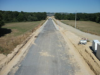
English: Vichy by-pass south-west under construction from a communal way from Les Taureaux to Le Bois Randen(n)ais, in Brugheas, Allier, Auvergne, France. Approximate elevation: 340 m/1,115 ft [8497]
Français : Contournement sud-ouest de Vichy en travaux, depuis un chemin communal reliant Les Taureaux au Bois Randen(n)ais, commune de Brugheas, Allier, Auvergne, France. Altitude approximative: 340 m [8497] |
| Date | Taken on 2 August 2015 |
| Source | Own work |
| Author | Tabl-trai |
ais_aux_Taureaux_(Brugheas)_2015-08-02.JPG)
heading=57°
Licensing
[edit]ais_aux_Taureaux_(Brugheas)_2015-08-02.JPG&action=edit§ion=2)
I, the copyright holder of this work, hereby publish it under the following license:
This file is licensed under the Creative Commons Attribution-Share Alike 3.0 Unported license.
- You are free:
- to share – to copy, distribute and transmit the work
- to remix – to adapt the work
- Under the following conditions:
- attribution – You must give appropriate credit, provide a link to the license, and indicate if changes were made. You may do so in any reasonable manner, but not in any way that suggests the licensor endorses you or your use.
- share alike – If you remix, transform, or build upon the material, you must distribute your contributions under the same or compatible license as the original.
File history
Click on a date/time to view the file as it appeared at that time.
| Date/Time | Thumbnail | Dimensions | User | Comment | |
|---|---|---|---|---|---|
| current | 10:44, 3 August 2015 | | 2,816 × 2,112 (1.63 MB) | Tabl-trai (talk | contribs) | {{Information |Description ={{en|1=Vichy by-pass south-west under construction from a communal way from ''Les Taureaux'' to ''Le Bois Randen(n)ais'', in Brugheas, Allier, Auvergne, France. Approximate elevation: 340 m/1,115 ft [8497]}} {{f... |
You cannot overwrite this file.
File usage on Commons
There are no pages that use this file.
File usage on other wikis
The following other wikis use this file:
- Usage on fr.wikipedia.org
ais_aux_Taureaux_(Brugheas)_2015-08-02.JPG&oldid=867858474)