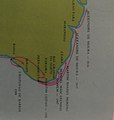
File:Conquista dos litorais nordeste e norte do Brasil 02.jpg

Original file (2,745 × 2,613 pixels, file size: 1.68 MB, MIME type: image/jpeg)
Captions
Captions
Summary
[edit]| DescriptionConquista dos litorais nordeste e norte do Brasil 02.jpg |
Português: Conquista portuguesa dos territórios das regiões Nordeste e Norte. O movimento ocorreu do sul, desde a Bahia, em direção ao norte, até a Amazônia. |
| Date | |
| Source | Enciclopédia Delta de História do Brasil |
| Author | Unknown authorUnknown author |
Licensing
[edit]| Public domainPublic domainfalsefalse |
This photograph is in the public domain in Brazil because it was created there before 19 June 1998 and, according to the 1973 Brazilian copyright law, is not considered to be an artistic creation. This applies to documentary photographs in general (commercial or not), as well as non-artistic photographic portraits. See here for some guidance on this.
This work is in the public domain in the United States because it meets three requirements:
The 1973 law was in force until being replaced by the current (non-retroactive) Law 9.610 of 19 February 1998 (see translation), which came into effect on 20 June 1998. Photographic works produced after that date follow the Law 9.610 regulations.
|
 |
File history
Click on a date/time to view the file as it appeared at that time.
| Date/Time | Thumbnail | Dimensions | User | Comment | |
|---|---|---|---|---|---|
| current | 03:40, 9 August 2022 |  | 2,745 × 2,613 (1.68 MB) | SteinsplitterBot (talk | contribs) | Bot: Image rotated by 270° (EXIF-Orientation set from 6 to 1, rotated 0°) |
| 02:30, 9 August 2022 |  | 2,613 × 2,745 (1.68 MB) | Bageense (talk | contribs) | Cropped 34 % horizontally, 16 % vertically using CropTool with precise mode. | |
| 02:27, 9 August 2022 |  | 3,120 × 4,160 (2.92 MB) | Bageense (talk | contribs) | Uploaded a work by Desconhecido from Enciclopédia Delta de História do Brasil with UploadWizard |
You cannot overwrite this file.
File usage on Commons
There are no pages that use this file.
File usage on other wikis
The following other wikis use this file:
- Usage on pt.wikipedia.org
Metadata
This file contains additional information such as Exif metadata which may have been added by the digital camera, scanner, or software program used to create or digitize it. If the file has been modified from its original state, some details such as the timestamp may not fully reflect those of the original file. The timestamp is only as accurate as the clock in the camera, and it may be completely wrong.
| Camera manufacturer | motorola |
|---|---|
| Camera model | motorola one |
| Exposure time | 1/15 sec (0.066666666666667) |
| F-number | f/2 |
| ISO speed rating | 1,906 |
| Date and time of data generation | 22:53, 8 August 2022 |
| Lens focal length | 3.463 mm |
| Orientation | Normal |
| Horizontal resolution | 72 dpi |
| Vertical resolution | 72 dpi |
| Software used | deen-user 10 QPKS30.54-22-27 92b8a release-keys |
| File change date and time | 22:53, 8 August 2022 |
| Y and C positioning | Centered |
| Exposure Program | Normal program |
| Exif version | 2.2 |
| Date and time of digitizing | 22:53, 8 August 2022 |
| Meaning of each component |
|
| APEX shutter speed | 3.906 |
| APEX aperture | 2 |
| APEX brightness | 0 |
| APEX exposure bias | 0 |
| Maximum land aperture | 2 APEX (f/2) |
| Metering mode | Center weighted average |
| Flash | Flash did not fire, compulsory flash suppression |
| DateTime subseconds | 486634 |
| DateTimeOriginal subseconds | 486634 |
| DateTimeDigitized subseconds | 486634 |
| Supported Flashpix version | 1 |
| Color space | sRGB |
| Scene type | A directly photographed image |
| Custom image processing | Normal process |
| Exposure mode | Auto exposure |
| White balance | Auto white balance |
| Digital zoom ratio | 1 |
| Scene capture type | Standard |
| Geodetic survey data used | WGS-84 |
| GPS tag version | 2.2.0.0 |