File:Collier's 1921 Virginia and West Virginia.jpg
Jump to navigation
Jump to search

Size of this preview: 800 × 517 pixels. Other resolutions: 320 × 207 pixels | 640 × 414 pixels | 1,024 × 662 pixels | 1,280 × 827 pixels | 3,085 × 1,994 pixels.
Original file (3,085 × 1,994 pixels, file size: 1.73 MB, MIME type: image/jpeg)
Captions
Captions
Add a one-line explanation of what this file represents
| Description |
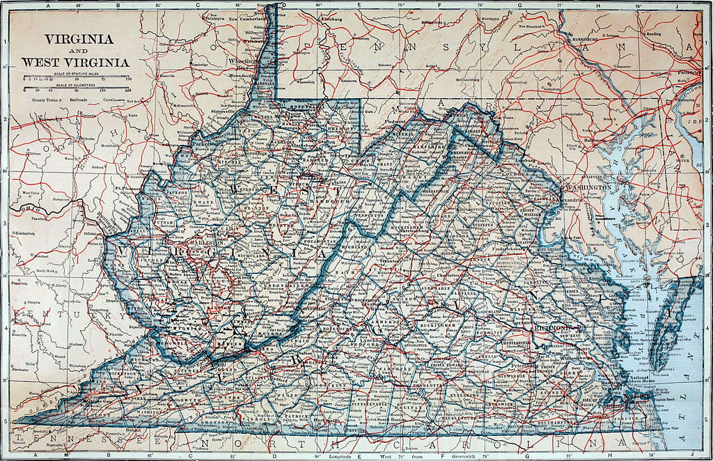
English: Topographical and political map of Virginia and West Virginia. |
||
| Date | |||
| Source | Collier's New Encyclopedia, v. 10, 1921, facing p. 231. | ||
| Author | L. L. Poates Eng. Co. | ||
| Permission (Reusing this file) |
|
Erratum: Full scale on the kilometer bar should be 160 rather than 140.
File history
Click on a date/time to view the file as it appeared at that time.
| Date/Time | Thumbnail | Dimensions | User | Comment | |
|---|---|---|---|---|---|
| current | 20:07, 30 March 2013 | | 3,085 × 1,994 (1.73 MB) | Bob Burkhardt (talk | contribs) | {{Information |Description={{en|Topographical and political map of Virginia and West Virginia.}} |Source=''Collier's New Encyclopedia'', v. 10, 1921, facing p. 231. |Date=1921 |Author=L. L. Poates Eng. Co. |Permission={{PD-1923}} |other_versions= }} Er... |
You cannot overwrite this file.
File usage on Commons
There are no pages that use this file.
File usage on other wikis
The following other wikis use this file: