File:Coastal defences plaque, Sunderland, Tyne & Wear, UK.jpg
Jump to navigation
Jump to search
Size of this preview: 694 × 600 pixels. Other resolutions: 278 × 240 pixels | 556 × 480 pixels | 889 × 768 pixels | 1,244 × 1,075 pixels.
Original file (1,244 × 1,075 pixels, file size: 413 KB, MIME type: image/jpeg)
Captions
Captions
Add a one-line explanation of what this file represents
Summary
[edit]
| Description |
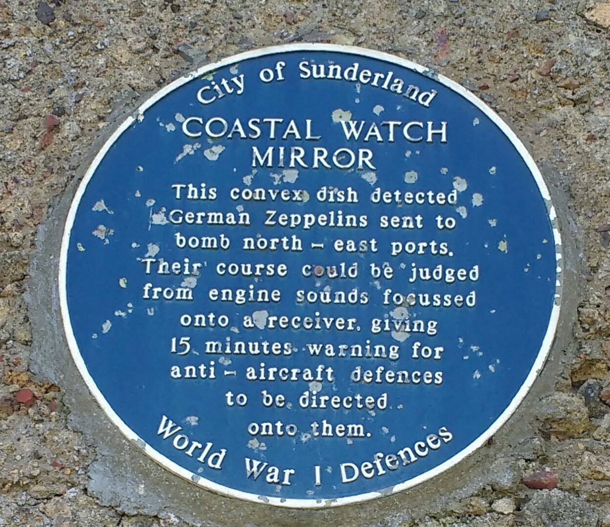
English: Plaque reads:
"City of Sunderland Coastal Watch Mirror This convex dish detected German Zeppelins sent to bomb north-east ports. Their course could be judged from engine sounds focussed onto a receiver, giving 15 minutes warning for anti-aircraft defences to be directed onto them. World War I Defences" |
| Date | |
| Source | Own work |
| Author | Millerdl |
| Camera location | | View this and other nearby images on: OpenStreetMap |
|---|
Licensing
[edit]
I, the copyright holder of this work, hereby publish it under the following license:
This file is licensed under the Creative Commons Attribution-Share Alike 4.0 International license.
- You are free:
- to share – to copy, distribute and transmit the work
- to remix – to adapt the work
- Under the following conditions:
- attribution – You must give appropriate credit, provide a link to the license, and indicate if changes were made. You may do so in any reasonable manner, but not in any way that suggests the licensor endorses you or your use.
- share alike – If you remix, transform, or build upon the material, you must distribute your contributions under the same or compatible license as the original.
File history
Click on a date/time to view the file as it appeared at that time.
| Date/Time | Thumbnail | Dimensions | User | Comment | |
|---|---|---|---|---|---|
| current | 19:47, 30 September 2018 | | 1,244 × 1,075 (413 KB) | Millerdl (talk | contribs) | User created page with UploadWizard |
You cannot overwrite this file.
File usage on Commons
There are no pages that use this file.