File:Cleridge cornfield.jpg
Jump to navigation
Jump to search

Size of this preview: 800 × 532 pixels. Other resolutions: 320 × 213 pixels | 640 × 426 pixels | 1,024 × 681 pixels | 1,280 × 851 pixels | 2,560 × 1,702 pixels | 6,016 × 4,000 pixels.
Original file (6,016 × 4,000 pixels, file size: 6.5 MB, MIME type: image/jpeg)
Captions
Captions
Add a one-line explanation of what this file represents
|
This is an image of a place or building that is listed on the National Register of Historic Places in the United States of America. Its reference number is 11000653. |
| Camera location | | View this and other nearby images on: OpenStreetMap |
|---|
| Description |
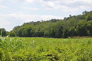
English: A small cornfield on the southern side of Old Charles Town Road in westernmost Clarke County, Virginia, United States, less than a minute's walk from the Frederick County line. These fields are part (as a contributing site) of the Cleridge estate, which is listed on the National Register of Historic Places. |
||
| Date | Taken on 15 July 2017 | ||
| Source | Own work | ||
| Author | Nyttend | ||
| Permission (Reusing this file) |
|
File history
Click on a date/time to view the file as it appeared at that time.
| Date/Time | Thumbnail | Dimensions | User | Comment | |
|---|---|---|---|---|---|
| current | 23:51, 16 July 2017 | | 6,016 × 4,000 (6.5 MB) | Nyttend (talk | contribs) | {{NRHP|11000653}} {{Location|39|13|31|N|78|3|33|W}} {{Information |Description={{en|A small cornfield on the southern side of Old Charles Town Road in westernmost {{w|Clarke County, Virginia|Clarke County}}, {{w|Virginia}}, {{w|United States}}, less th... |
You cannot overwrite this file.
File usage on Commons
There are no pages that use this file.
File usage on other wikis
The following other wikis use this file:
- Usage on en.wikipedia.org