File:Map Cleomenean War-en.svg
(Redirected from File:Cleomenean War Overview.svg)

Size of this PNG preview of this SVG file: 431 × 542 pixels. Other resolutions: 191 × 240 pixels | 382 × 480 pixels | 611 × 768 pixels | 814 × 1,024 pixels | 1,628 × 2,048 pixels.
Original file (SVG file, nominally 431 × 542 pixels, file size: 982 KB)
Captions
Captions
Add a one-line explanation of what this file represents
Summary
[edit]| Description |
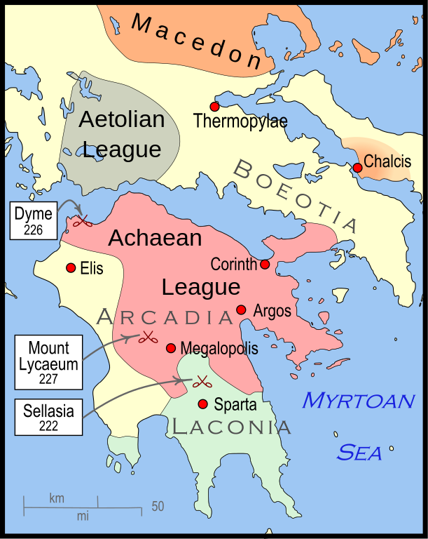
English: Mainland Greece during the time of the Cleomenean War, ca. 228 BCE |
| Date | |
| Source | Own work |
| Author | MapMaster |
| Other versions |
[]
|


-pt.svg)


References
[edit]
The map itself was built using File:Greece map blank.svg, adding the now-drained Lake Copais. Towns were placed using geographic coordinates.
The borders of the various political entities were taken from several sources:
- Chamoux, François (2002) Hellenistic civilization, Wiley-Blackwell, ISBN 9780631222422, p. 206, for the Achaean League. I did not use this for the Aetolian League, since this map shows the later and larger borders of the Aetolian League, after the Cleomenean War.
- Gabbert, Janice J. (1997) Antigonus II Gonatas: a political biography, Routledge, ISBN 9780415018999 , p. 33, for the area under the control of Macedon.
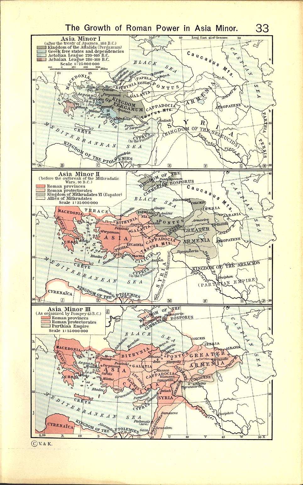
- Shepherd, William (1911) "The Growth of Roman Power in Asia Minor", Historical Atlas, Henry Holt and Company. p. 33, was used as the primary reference for the Aetolian League.
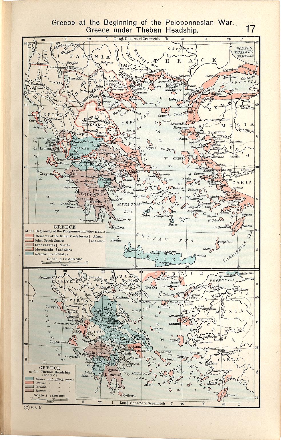
- Shepherd, William (1911) "Greece under Theban Headship", Historical Atlas, Henry Holt and Company. p. 17, was used as the primary reference for the Spartan borders. When there was a conflict with the Chamoux map, I used the Chamoux map.
Any additional information on borders and areas under control would be very welcome.
Similar maps
[edit]

Licensing
[edit]
I, the copyright holder of this work, hereby publish it under the following license:
This file is licensed under the Creative Commons Attribution-Share Alike 3.0 Unported license.
- You are free:
- to share – to copy, distribute and transmit the work
- to remix – to adapt the work
- Under the following conditions:
- attribution – You must give appropriate credit, provide a link to the license, and indicate if changes were made. You may do so in any reasonable manner, but not in any way that suggests the licensor endorses you or your use.
- share alike – If you remix, transform, or build upon the material, you must distribute your contributions under the same or compatible license as the original.
File history
Click on a date/time to view the file as it appeared at that time.
| Date/Time | Thumbnail | Dimensions | User | Comment | |
|---|---|---|---|---|---|
| current | 04:57, 12 January 2010 | | 431 × 542 (982 KB) | MapMaster (talk | contribs) | {{Information |Description={{en|1=A map of Greece during the Cleomenean War}} |Source={{own}} |Author=MapMaster |Date=11 January 2010 |Permission= |other_versions= }} Category:Maps of the history of Greece |
You cannot overwrite this file.
File usage on Commons
The following 13 pages use this file:
- File:Cleomenean War Overview.svg (file redirect)
- File:Cleomenes War detail 1.svg
- File:Map Cleomenean War-en.svg
- File:Map Cleomenean War-es.svg
- File:Map Cleomenean War-fr.svg
- File:Map Cleomenean War-he.svg
- File:Map Cleomenean War-hu.svg
- File:Map Cleomenean War-it.svg
- File:Map Cleomenean War-pt.svg
- File:Map Cleomenean War-zh.svg
- File:Map Cleomenean War (geo)-pt.svg
- Template:Other versions/Map Cleomenean War
- Category:Cleomenean War
File usage on other wikis
The following other wikis use this file:
- Usage on ar.wikipedia.org
- Usage on bg.wikipedia.org
- Usage on ca.wikipedia.org
- Usage on el.wikipedia.org
- Usage on en.wikipedia.org
- Usage on et.wikipedia.org
- Usage on he.wikipedia.org
- Usage on it.wikipedia.org
- Usage on ja.wikipedia.org
- Usage on ko.wikipedia.org
- Usage on nl.wikipedia.org
- Usage on sh.wikipedia.org
- Usage on tr.wikipedia.org
- Usage on uk.wikipedia.org
- Usage on vi.wikipedia.org
- Usage on www.wikidata.org
- Usage on zh.wikipedia.org