File:Class373-eurostar-north-downs-tunnel-high-speed-1-telephoto.jpg
Jump to navigation
Jump to search
Size of this preview: 790 × 599 pixels. Other resolutions: 316 × 240 pixels | 633 × 480 pixels | 1,012 × 768 pixels | 1,280 × 971 pixels | 1,600 × 1,214 pixels.
Original file (1,600 × 1,214 pixels, file size: 449 KB, MIME type: image/jpeg)
Captions
Captions
Add a one-line explanation of what this file represents
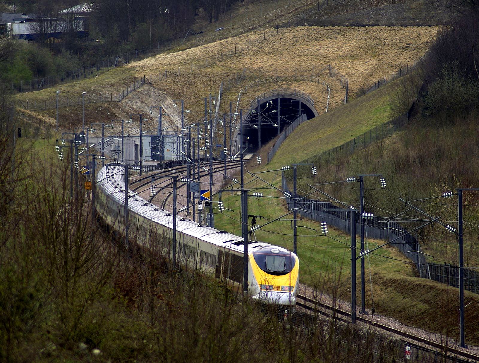
| Description | en:British Rail Class 373 train on en:Eurostar service heading out of the en:Medway Towns on the HS1 (en:High Speed 1) line having just crossed the en:Medway Vidaucts and about to enter the en:North Downs Tunnel under en:Blue Bell Hill. The train is southbound on the CTRL Down at the "56 KM" mark (56 kilometres from London) travelling at 270–300 km/h. Based on time of photograph, probably Fridays-only non-stop service 9022 (St Pancras 11:32→Gare du Nord 14:47). | ||
| Date | |||
| Source | Flickr: EUROSTAR | ||
| Author | UNKIEPAUL / Paul Johnston | ||
| Permission (Reusing this file) |
This file is licensed under the Creative Commons Attribution-Share Alike 2.0 Generic license.
|
| Camera location | | View this and other nearby images on: OpenStreetMap |
|---|
| Object location | | View this and other nearby images on: OpenStreetMap |
|---|
File history
Click on a date/time to view the file as it appeared at that time.
| Date/Time | Thumbnail | Dimensions | User | Comment | |
|---|---|---|---|---|---|
| current | 11:24, 11 September 2011 | | 1,600 × 1,214 (449 KB) | Flickr upload bot (talk | contribs) | Uploaded from http://flickr.com/photo/8168925@N02/3390258220 using Flickr upload bot |
You cannot overwrite this file.
File usage on Commons
The following page uses this file:
File usage on other wikis
The following other wikis use this file:
- Usage on en.wikipedia.org
- Usage on www.wikidata.org