File:Civil War Memorial North Adams.jpg
Jump to navigation
Jump to search

Size of this preview: 345 × 600 pixels. Other resolutions: 138 × 240 pixels | 276 × 480 pixels | 441 × 768 pixels | 1,119 × 1,946 pixels.
Original file (1,119 × 1,946 pixels, file size: 526 KB, MIME type: image/jpeg)
Captions
Captions
Add a one-line explanation of what this file represents
Summary
[edit]
|
This is an image of a place or building that is listed on the National Register of Historic Places in the United States of America. Its reference number is 72000132. |
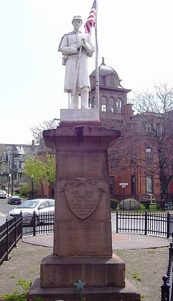
| Description | The Civil War memorial on Monument Square, just west of the intersection between Main Street and Church Street in North Adams, Massachusetts, is located within the expanded boundaries of the Monument Square-Eagle Street Historic District. In the background is the public library. |
| Date | |
| Source | Own work |
| Author | Beyond My Ken |
| Camera location | | View this and other nearby images on: OpenStreetMap |
|---|
Licensing
[edit]
I, the copyright holder of this work, hereby publish it under the following licenses:

|
Permission is granted to copy, distribute and/or modify this document under the terms of the GNU Free Documentation License, Version 1.2 or any later version published by the Free Software Foundation; with no Invariant Sections, no Front-Cover Texts, and no Back-Cover Texts. A copy of the license is included in the section entitled GNU Free Documentation License. |
This file is licensed under the Creative Commons Attribution-Share Alike Attribution-Share Alike 4.0 International, 3.0 Unported, 2.5 Generic, 2.0 Generic and 1.0 Generic license.
- You are free:
- to share – to copy, distribute and transmit the work
- to remix – to adapt the work
- Under the following conditions:
- attribution – You must give appropriate credit, provide a link to the license, and indicate if changes were made. You may do so in any reasonable manner, but not in any way that suggests the licensor endorses you or your use.
- share alike – If you remix, transform, or build upon the material, you must distribute your contributions under the same or compatible license as the original.
You may select the license of your choice.
File history
Click on a date/time to view the file as it appeared at that time.
| Date/Time | Thumbnail | Dimensions | User | Comment | |
|---|---|---|---|---|---|
| current | 20:21, 18 July 2012 | | 1,119 × 1,946 (526 KB) | Beyond My Ken (talk | contribs) | {{Information |Description= The Civil War memorial on Monument Square, just west of the intersection between Main Street and Chruch Street in North Adams, Massachusetts, is located within the expanded boundaries of the Monument Square-Eagle Street Hist... |
You cannot overwrite this file.
File usage on Commons
There are no pages that use this file.
File usage on other wikis
The following other wikis use this file:
- Usage on de.wikipedia.org
- Usage on en.wikipedia.org