File:Citadel Sink Wupatki National Monument.jpg
Jump to navigation
Jump to search

Size of this preview: 800 × 370 pixels. Other resolutions: 320 × 148 pixels | 640 × 296 pixels | 1,024 × 473 pixels | 1,280 × 591 pixels | 4,000 × 1,848 pixels.
Original file (4,000 × 1,848 pixels, file size: 3.84 MB, MIME type: image/jpeg)
Captions
Captions
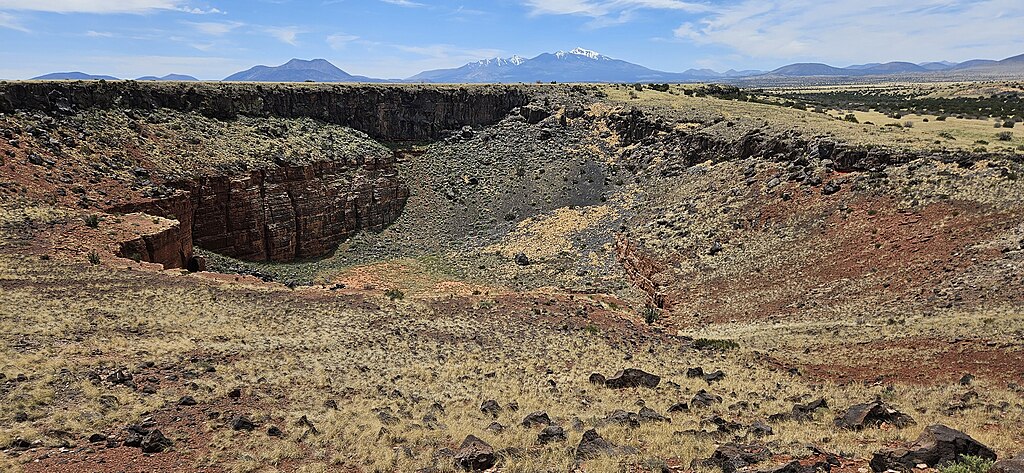
Citadel Sink at Wupatki National Monument, with the San Francisco Peaks in the distance looking southwest.
Summary
[edit]
| Description |
English: Citadel Sinkhole at Wupatki National Monument, with the San Francisco Peaks in the distance looking southwest. The sinkhole is formed by acidic rainwater seeping through cracks in the surface. The rain dissolved the limestone below, causing the ground to collapse above. It is around 600 feet in diameter. |
| Date | |
| Source | Own work |
| Author | Milonica |
| Camera location | | View this and other nearby images on: OpenStreetMap |
|---|
Licensing
[edit]
I, the copyright holder of this work, hereby publish it under the following license:
This file is licensed under the Creative Commons Attribution 4.0 International license.
- You are free:
- to share – to copy, distribute and transmit the work
- to remix – to adapt the work
- Under the following conditions:
- attribution – You must give appropriate credit, provide a link to the license, and indicate if changes were made. You may do so in any reasonable manner, but not in any way that suggests the licensor endorses you or your use.
File history
Click on a date/time to view the file as it appeared at that time.
| Date/Time | Thumbnail | Dimensions | User | Comment | |
|---|---|---|---|---|---|
| current | 20:33, 29 May 2024 | | 4,000 × 1,848 (3.84 MB) | Milonica (talk | contribs) | Uploaded own work with UploadWizard |
You cannot overwrite this file.
File usage on Commons
There are no pages that use this file.
File usage on other wikis
The following other wikis use this file:
- Usage on en.wikipedia.org