File:Ciechanowiec - na mapie w 1937 r.jpg
Jump to navigation
Jump to search

Size of this preview: 800 × 497 pixels. Other resolutions: 320 × 199 pixels | 640 × 397 pixels | 1,024 × 636 pixels | 1,419 × 881 pixels.
Original file (1,419 × 881 pixels, file size: 607 KB, MIME type: image/jpeg)
Captions
Captions
Add a one-line explanation of what this file represents
Summary
[edit]
| Description |
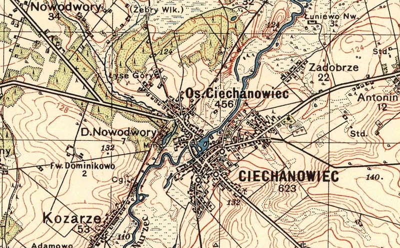
Polski: Od 21 kwietnia 1938 roku z gminy Klukowo przeniesiono osadę miejską Ciechanowiec do miasta Ciechanowca w powiecie bielskim. Korespondencja w tej sprawie toczyła się przynajmniej od 1931 r. Sugerowano przeniesienie osady Ciechanowiec do powiatu bielskiego, względnie włączenie miasta Ciechanowca do powiatu wysokomazowieckiego. |
| Date | |
| Source | Mapa Ciechanowiec, Pas 38 Słup 35, skala 1: 100 000 Wojskowy Instytut Geograficzny z 1937 r. |
| Author | Unknown author |
Licensing
[edit]
|
This work is in the public domain in its country of origin and other countries and areas where the copyright term is the author's life plus 70 years or fewer. | |
| This file has been identified as being free of known restrictions under copyright law, including all related and neighboring rights. | |
File history
Click on a date/time to view the file as it appeared at that time.
| Date/Time | Thumbnail | Dimensions | User | Comment | |
|---|---|---|---|---|---|
| current | 11:30, 7 September 2015 | | 1,419 × 881 (607 KB) | Adam-dalekie-pole (talk | contribs) | User created page with UploadWizard |
You cannot overwrite this file.
File usage on Commons
There are no pages that use this file.