File:Cia-is-map.gif
Jump to navigation
Jump to search
Size of this preview: 276 × 598 pixels. Other resolutions: 110 × 240 pixels | 330 × 715 pixels.
Original file (330 × 715 pixels, file size: 21 KB, MIME type: image/gif)
Captions
Captions
Add a one-line explanation of what this file represents
Summary
[edit]
| Description |
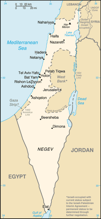
English: Map of Israel and Palestinian Occupied Territories |
| Source | CIA World Factbook |
| Author | U.S. Central Intelligence Agency |
Licensing
[edit]
This image is in the public domain because it contains materials that originally came from the United States Central Intelligence Agency's World Factbook.
|
 |
Original upload log
[edit]
The original description page was here. All following user names refer to en.wikipedia.
| Date/Time | Dimensions | User | Comment |
|---|---|---|---|
| 2005-09-15 17:26 | 330×715× (21371 bytes) | Marsden | Map of Israel from Central Intelligence Agency |
File history
Click on a date/time to view the file as it appeared at that time.
| Date/Time | Thumbnail | Dimensions | User | Comment | |
|---|---|---|---|---|---|
| current | 04:30, 8 December 2016 | | 330 × 715 (21 KB) | FixFixer (talk | contribs) | Transferred from en.wikipedia |
You cannot overwrite this file.
File usage on Commons
The following page uses this file:
File usage on other wikis
The following other wikis use this file:
- Usage on udm.wikipedia.org
- Usage on vi.wikipedia.org