File:Chuuk.png
Jump to navigation
Jump to search

Size of this preview: 797 × 599 pixels. Other resolutions: 319 × 240 pixels | 638 × 480 pixels | 1,021 × 768 pixels | 1,280 × 963 pixels | 1,637 × 1,231 pixels.
Original file (1,637 × 1,231 pixels, file size: 177 KB, MIME type: image/png)
Captions
Captions
Add a one-line explanation of what this file represents
Summary
[edit]
| Description |
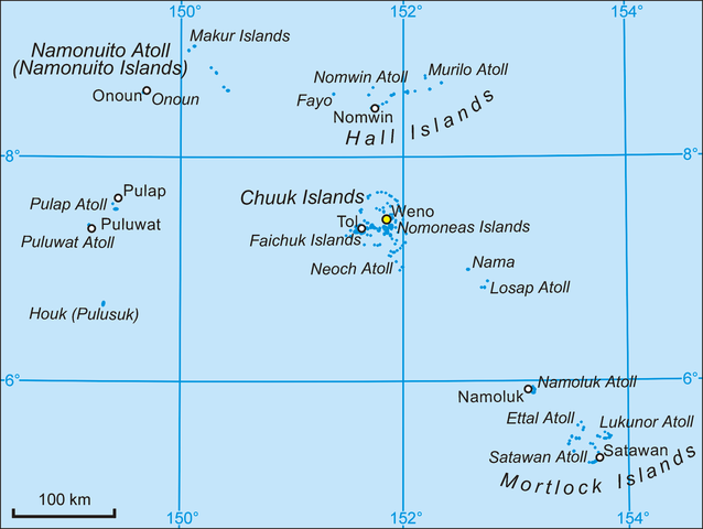
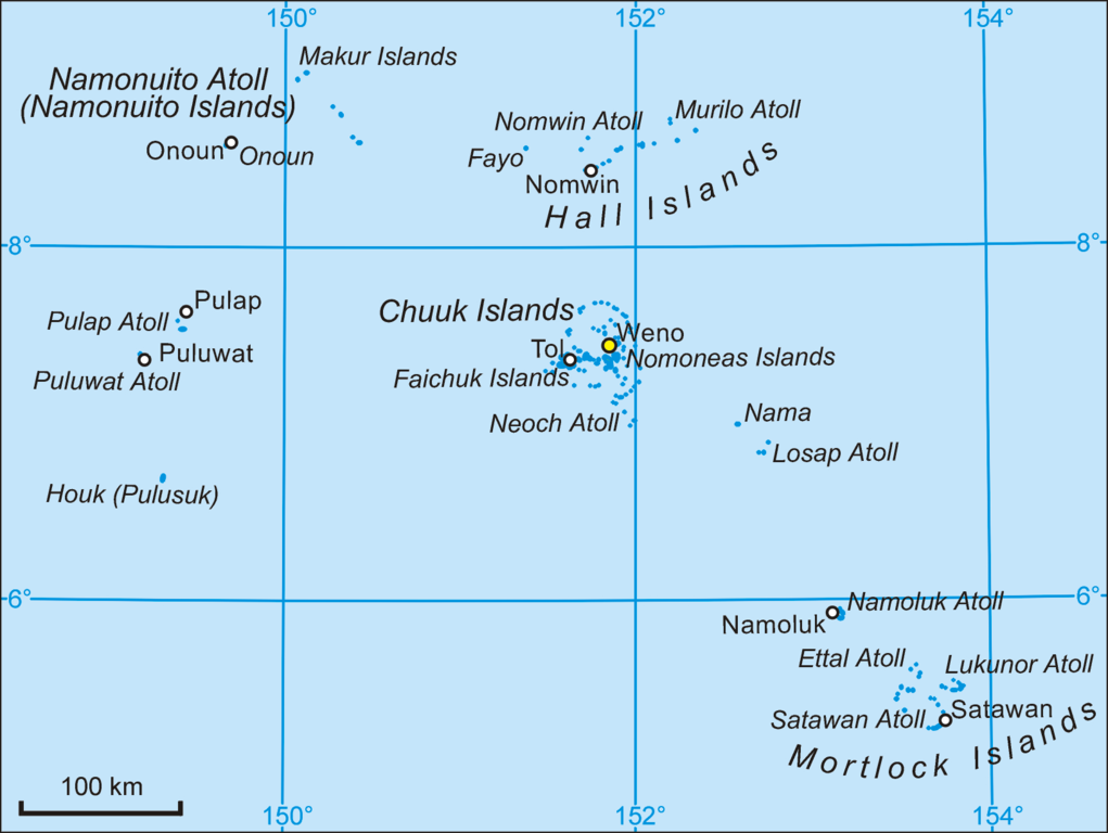
English: Map of Chuuk State, Micronesia.
Polski: Mapa stanu Chuuk w Mikronezji. |
| Date | 4 February 2006 (original upload date) |
| Source | Self-made and transferred from pl.wikipedia |
| Author | Aotearoa at Polish Wikipedia |
Licensing
[edit]
| I, the copyright holder of this work, release this work into the public domain. This applies worldwide. In some countries this may not be legally possible; if so: I grant anyone the right to use this work for any purpose, without any conditions, unless such conditions are required by law. |
Original upload log
[edit]
The original description page was here. All following user names refer to pl.wikipedia.
- 2006-02-04 09:45 Aotearoa 1637×1231×8 (181692 bytes) Mapa stanu Chuuk w Mikronezji. Autor [[Wikipedysta:Aotearoa|Aotearoa]]
File history
Click on a date/time to view the file as it appeared at that time.
| Date/Time | Thumbnail | Dimensions | User | Comment | |
|---|---|---|---|---|---|
| current | 06:55, 14 February 2006 | | 1,637 × 1,231 (177 KB) | Aotearoa (talk | contribs) | Map of Chuuk State, Micronesia. Author: Aotearoa from Poland |
You cannot overwrite this file.
File usage on Commons
The following page uses this file:
File usage on other wikis
The following other wikis use this file:
- Usage on ar.wikipedia.org
- Usage on da.wikipedia.org
- Usage on de.wikipedia.org
- Föderierte Staaten von Mikronesien
- Mortlocks
- Chuuk (Bundesstaat)
- Mortlock Islands
- Losap
- Liste der Inseln der Föderierten Staaten von Mikronesien
- Hall Islands
- Oksoritod
- Vorlage:Infobox Verwaltungsgebiet (Insel)
- Vorlage:Infobox Verwaltungsgebiet (Insel)/Doku
- Nama (Insel)
- Etal (Atoll)
- Lukunor
- Pulap
- Houk (Insel)
- Fayu (Atoll)
- Nomwin
- Murilo
- James Mortlock
- Usage on en.wikipedia.org
- Usage on es.wikipedia.org
- Usage on fa.wikipedia.org
- Usage on fi.wikipedia.org
- Usage on fr.wikipedia.org
- Usage on hr.wikipedia.org
- Usage on id.wikipedia.org
- Usage on it.wikipedia.org
View more global usage of this file.