File:Chure range of nepal , province no. 1.jpg
Jump to navigation
Jump to search
Size of this preview: 450 × 600 pixels. Other resolutions: 180 × 240 pixels | 360 × 480 pixels | 576 × 768 pixels | 768 × 1,024 pixels | 2,448 × 3,262 pixels.
Original file (2,448 × 3,262 pixels, file size: 2.32 MB, MIME type: image/jpeg)
Captions
Captions
Add a one-line explanation of what this file represents
Summary
[edit]| Description |
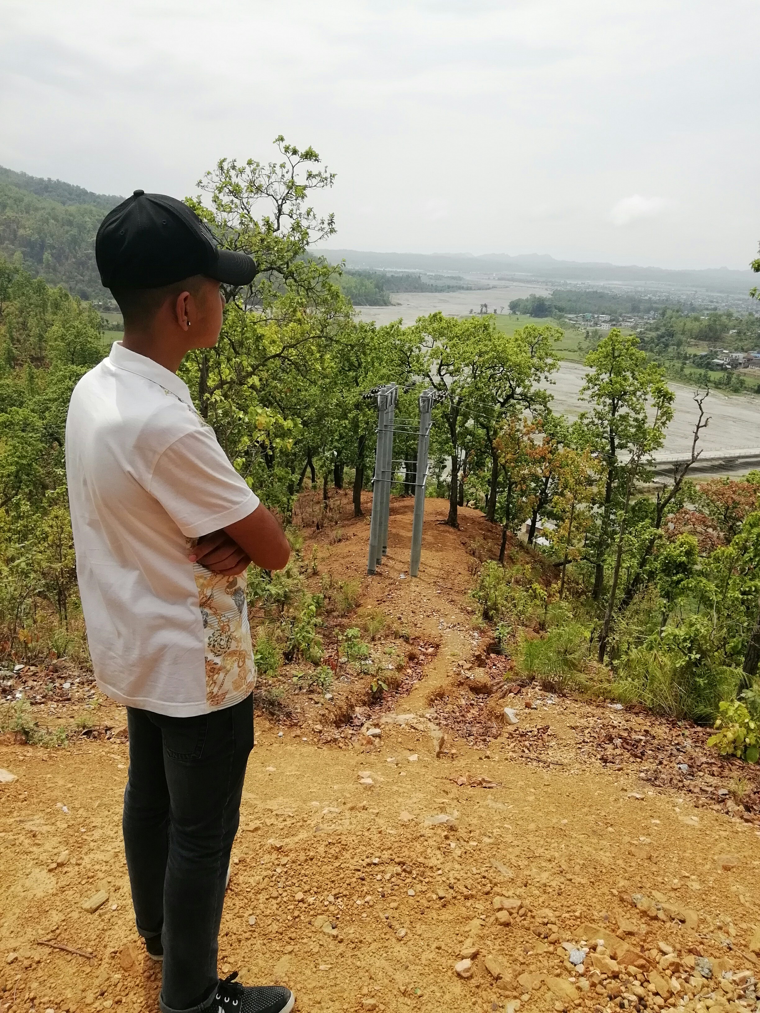
English: View over Baruwa River at Gaighat (in Triyuga municipality, Udayapur district), Nepal. – This is heaven on eastern region of Nepal, near Gaighat, Udayapur district. It describes the Chure or Shiwalik range of Nepal. It also highlights the current status of Chure range. In the photo we can see a nearly dried up river called Baruwa River. It used to flow thundering ly before. But due to climate change and excessive deforestation it has nearly dried. Finally it also illustrates the beauty of Chure range and need of its conservation. |
| Date | |
| Source | Own work |
| Author | Adarsh basnet |
| Other versions |
|

Licensing
[edit]
I, the copyright holder of this work, hereby publish it under the following license:
This file is licensed under the Creative Commons Attribution-Share Alike 4.0 International license.
- You are free:
- to share – to copy, distribute and transmit the work
- to remix – to adapt the work
- Under the following conditions:
- attribution – You must give appropriate credit, provide a link to the license, and indicate if changes were made. You may do so in any reasonable manner, but not in any way that suggests the licensor endorses you or your use.
- share alike – If you remix, transform, or build upon the material, you must distribute your contributions under the same or compatible license as the original.
This image was uploaded as part of Wiki Loves Earth 2018.
|
 |
File history
Click on a date/time to view the file as it appeared at that time.
| Date/Time | Thumbnail | Dimensions | User | Comment | |
|---|---|---|---|---|---|
| current | 06:37, 3 May 2018 | | 2,448 × 3,262 (2.32 MB) | Adarsh basnet (talk | contribs) | User created page with UploadWizard |
You cannot overwrite this file.
File usage on Commons
The following page uses this file: