File:Church of St Peter, St Paul and St John (geograph 6328359).jpg
Jump to navigation
Jump to search

Size of this preview: 800 × 533 pixels. Other resolutions: 320 × 213 pixels | 640 × 427 pixels | 1,024 × 683 pixels | 1,280 × 853 pixels | 2,560 × 1,707 pixels | 4,896 × 3,264 pixels.
Original file (4,896 × 3,264 pixels, file size: 6.72 MB, MIME type: image/jpeg)
Captions
Captions
Add a one-line explanation of what this file represents
Summary
[edit].jpg&action=edit§ion=1)
| Description |
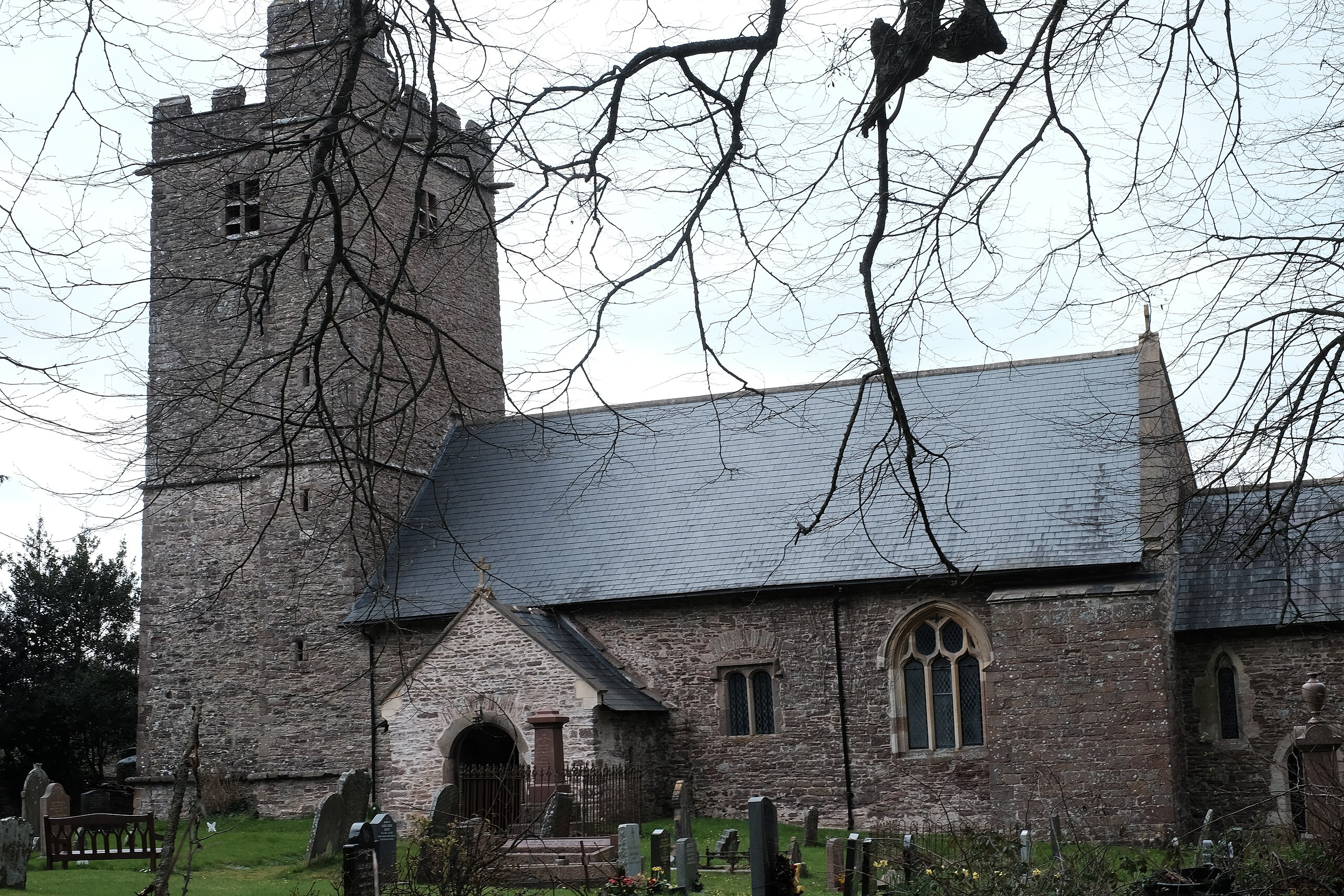
English: Church of St Peter, St Paul and St John. The church in Llantrisant is dedicated to three saints. As usual, it's a Victorian restoration of an older church with some of the original elements surviving to this day. It was reroofed in 2009, as shown in Philip Halling's picture of the church, taken on a rather sunnier day than my photo. The rural setting is deceptive: the busy A449 dual carriageway passes within a couple of hundred metres of the church. |
| Date | |
| Source | From geograph.org.uk |
| Author | John Winder |
| Permission (Reusing this file) |
Creative Commons Attribution Share-alike license 2.0 |
| Attribution (required by the license) | John Winder / Church of St Peter, St Paul and St John / |
| Camera location | | View this and other nearby images on: OpenStreetMap |
|---|
.jpg¶ms=051.667565_N_-002.881251_E_globe:Earth_type:camera_source:geograph-osgb36(ST39159690)_heading:315.00&language=en)
| Object location | | View this and other nearby images on: OpenStreetMap |
|---|
.jpg¶ms=051.667740_N_-002.881690_E_globe:Earth_class:object_type:object_source:geograph-osgb36(ST39129692)_heading:315.00&language=en)
Licensing
[edit].jpg&action=edit§ion=2)

|
This image was taken from the Geograph project collection. See this photograph's page on the Geograph website for the photographer's contact details. The copyright on this image is owned by John Winder and is licensed for reuse under the Creative Commons Attribution-ShareAlike 2.0 license.
|
This file is licensed under the Creative Commons Attribution-Share Alike 2.0 Generic license.
Attribution: John Winder
- You are free:
- to share – to copy, distribute and transmit the work
- to remix – to adapt the work
- Under the following conditions:
- attribution – You must give appropriate credit, provide a link to the license, and indicate if changes were made. You may do so in any reasonable manner, but not in any way that suggests the licensor endorses you or your use.
- share alike – If you remix, transform, or build upon the material, you must distribute your contributions under the same or compatible license as the original.
File history
Click on a date/time to view the file as it appeared at that time.
| Date/Time | Thumbnail | Dimensions | User | Comment | |
|---|---|---|---|---|---|
| current | 17:40, 25 July 2021 | | 4,896 × 3,264 (6.72 MB) | Salen9 (talk | contribs) | == {{int:filedesc}} == {{Information |Description={{en|1=Church of St Peter, St Paul and St John}} |Source=From [https://www.geograph.org.uk/photo/6328359 geograph.org.uk] |Date=2019-03-22 |Author=[https://www.geograph.org.uk/profile/68333 John Winder] |Permission=Creative Commons Attribution Share-alike license 2.0 |Other fields={{Credit line |Author=John Winder |License=[https://creativecommons.org/licenses/by-sa/2.0/ CC BY-SA 2.0] |Other=''Church of St Peter, St Paul and St John'' }} }... |
You cannot overwrite this file.
File usage on Commons
There are no pages that use this file.
.jpg&oldid=860442279)