File:Church Way - geograph.org.uk - 1220995.jpg
Jump to navigation
Jump to search
No higher resolution available.
Church_Way_-_geograph.org.uk_-_1220995.jpg (640 × 427 pixels, file size: 287 KB, MIME type: image/jpeg)
Captions
Captions
Add a one-line explanation of what this file represents
Summary
[edit]
| Description |
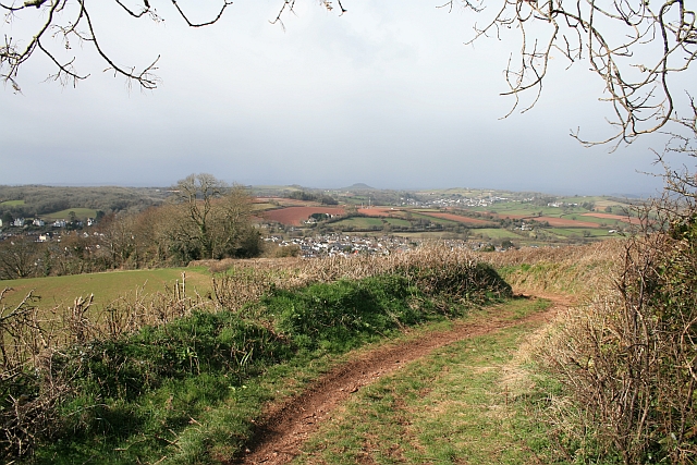
English: Church Way A dog-leg near Kerswell Hill in this unsurfaced public road between Kingskerswell and Coffinswell. This is one of many such roads in Devon to escape being tarred in the early 1900s, but just like any other road, there are manhole covers at intervals for access to services buried in the subsoil. |
| Date | |
| Source | From geograph.org.uk |
| Author | Hugh Craddock |
| Attribution (required by the license) | Hugh Craddock / Church Way / |
| Camera location | | View this and other nearby images on: OpenStreetMap |
|---|
_heading:292.00&language=en)
| Object location | | View this and other nearby images on: OpenStreetMap |
|---|
_heading:292.00&language=en)
Licensing
[edit]

|
This image was taken from the Geograph project collection. See this photograph's page on the Geograph website for the photographer's contact details. The copyright on this image is owned by Hugh Craddock and is licensed for reuse under the Creative Commons Attribution-ShareAlike 2.0 license.
|
This file is licensed under the Creative Commons Attribution-Share Alike 2.0 Generic license.
Attribution: Hugh Craddock
- You are free:
- to share – to copy, distribute and transmit the work
- to remix – to adapt the work
- Under the following conditions:
- attribution – You must give appropriate credit, provide a link to the license, and indicate if changes were made. You may do so in any reasonable manner, but not in any way that suggests the licensor endorses you or your use.
- share alike – If you remix, transform, or build upon the material, you must distribute your contributions under the same or compatible license as the original.
File history
Click on a date/time to view the file as it appeared at that time.
| Date/Time | Thumbnail | Dimensions | User | Comment | |
|---|---|---|---|---|---|
| current | 09:28, 26 February 2011 | | 640 × 427 (287 KB) | GeographBot (talk | contribs) | == {{int:filedesc}} == {{Information |description={{en|1=Church Way A dog-leg near Kerswell Hill in this unsurfaced public road between Kingskerswell and Coffinswell. This is one of many such roads in Devon to escape being tarred in the early 1900s, but j |
You cannot overwrite this file.
File usage on Commons
There are no pages that use this file.