File:China BV043423386 (cropped).jpg
Jump to navigation
Jump to search
Size of this preview: 597 × 600 pixels. Other resolutions: 239 × 240 pixels | 478 × 480 pixels | 765 × 768 pixels | 1,019 × 1,024 pixels | 1,576 × 1,583 pixels.
Original file (1,576 × 1,583 pixels, file size: 274 KB, MIME type: image/jpeg)
Captions
Captions
Add a one-line explanation of what this file represents
Summary
[edit]| Title |
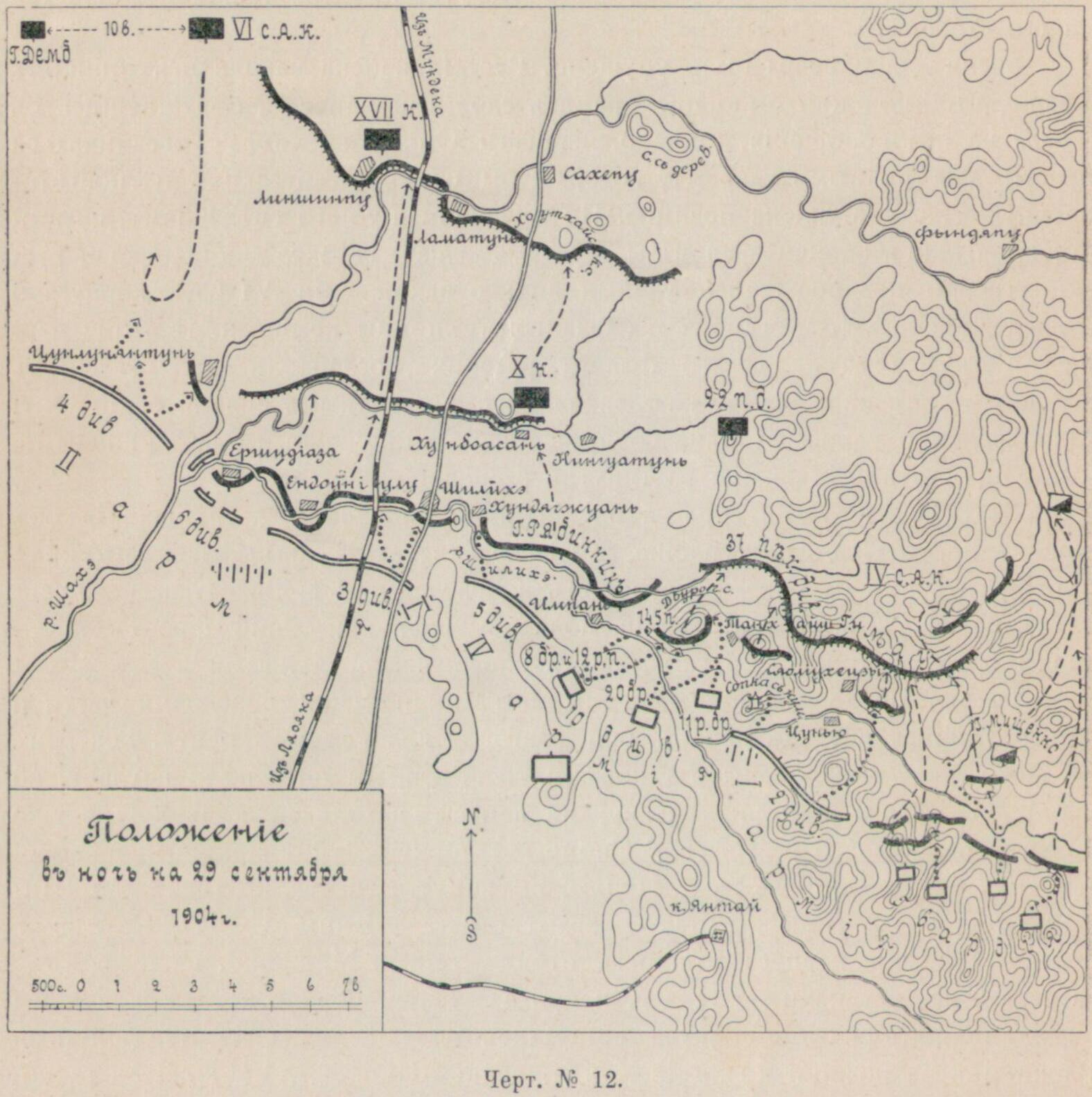
Položenīe v noč' na 29 sentjabrja 1904 g. |
|||||||||||||||||||||||
| Description |
Deutsch: China, Mandschurei, Russisch-JapanischerKrieg |
|||||||||||||||||||||||
| Date | ||||||||||||||||||||||||
| Source | Leibniz-Institut für Ost- und Südosteuropaforschung (IOS) GeoPortOst | |||||||||||||||||||||||
| Permission (Reusing this file) |
|
|||||||||||||||||||||||
| Geotemporal data | ||||||||||||||||||||||||
| Date depicted | ||||||||||||||||||||||||
| Map location | China | |||||||||||||||||||||||
| Map type | Geschichtskarte | |||||||||||||||||||||||
| Bounding box |
|
|||||||||||||||||||||||
| Georeferencing | ||||||||||||||||||||||||
| Bibliographic data | ||||||||||||||||||||||||
| Map sheet | S. 134 | |||||||||||||||||||||||
| Language | Russian | |||||||||||||||||||||||
| Archival data | ||||||||||||||||||||||||
| Collection |
|
|||||||||||||||||||||||
| Accession number |
BV043423386 |
|||||||||||||||||||||||
| Other versions | ||||||||||||||||||||||||


.jpg&action=edit§ion=1)
Licensing
[edit].jpg&action=edit§ion=2)
|
This work is in the public domain in its country of origin and other countries and areas where the copyright term is the author's life plus 70 years or fewer. | |
| This file has been identified as being free of known restrictions under copyright law, including all related and neighboring rights. | |
File history
Click on a date/time to view the file as it appeared at that time.
| Date/Time | Thumbnail | Dimensions | User | Comment | |
|---|---|---|---|---|---|
| current | 19:41, 17 August 2023 | | 1,576 × 1,583 (274 KB) | Enyavar (talk | contribs) | File:China BV043423386.jpg cropped 27 % horizontally, 52 % vertically using CropTool with precise mode. |
You cannot overwrite this file.
File usage on Commons
The following 2 pages use this file:
.jpg&oldid=856353254)