File:China.TMO2002163 lrg.jpg

Original file (2,600 × 2,000 pixels, file size: 967 KB, MIME type: image/jpeg)
Captions
Captions
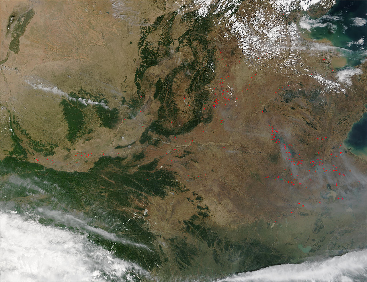
Pollution over Eastern China 華北/華東的空氣污染
Credit: Jacques Descloitres, MODIS Rapid Response Team, NASA/GSFC
On June 12, 2002, the Moderate Resolution Imaging Spectroradiometer (MODIS) on the Terra satellite captured this image of eastern China, showing numerous fires (red dots) and haze, probably a combination of smoke and urban pollution.
The Huang He (Yellow River) enters the image at top center and flows southward just to the west of the forested mountains. In roughly the center of the image, the Huang He veers sharply eastward and flows northeastward out to the bay known as Bo Hai.
Please note that the high-resolution scene provided here is 500 meters per pixel. For a copy of the scene at the sensor's fullest resolution, visit the MODIS Rapid Response Image Gallery.
照片來源:美國國家航空暨太空總署 Jacques Descloitres
這幅圖像是由美國航空航天署的衛星在2002年6月12日拍攝的.圖像顯示了分散各地的無數個著火處(小紅圈表示)以及很可能是他們引生的霧霾.
參見:中國的空氣污染
| This file is in the public domain in the United States because it was solely created by NASA. NASA copyright policy states that "NASA material is not protected by copyright unless noted". (See Template:PD-USGov, NASA copyright policy page or JPL Image Use Policy.) | ||
 |
Warnings:
|
File history
Click on a date/time to view the file as it appeared at that time.
| Date/Time | Thumbnail | Dimensions | User | Comment | |
|---|---|---|---|---|---|
| current | 04:42, 20 March 2005 | | 2,600 × 2,000 (967 KB) | R.O.C (talk | contribs) | Pollution over Eastern China 華北/華東的空氣污染 |
You cannot overwrite this file.
File usage on Commons
There are no pages that use this file.
File usage on other wikis
The following other wikis use this file:
- Usage on zh.wikipedia.org