File:Chiltern Main Line map.png
Jump to navigation
Jump to search

Size of this preview: 682 × 599 pixels. Other resolutions: 273 × 240 pixels | 546 × 480 pixels | 866 × 761 pixels.
Original file (866 × 761 pixels, file size: 114 KB, MIME type: image/png)
Captions
Captions
Add a one-line explanation of what this file represents
Summary
[edit]
| Description |
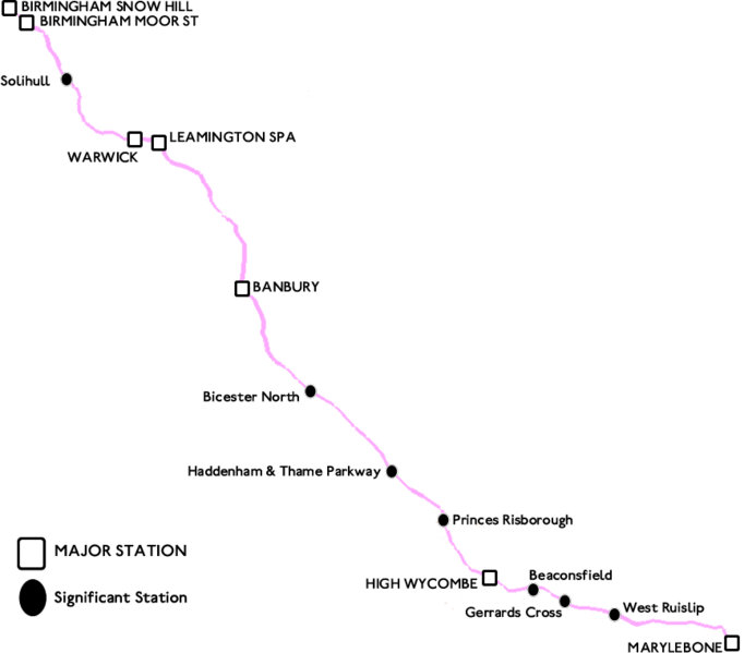
English: A geographically accurate map of the Chiltern Main Line complete with major and significant stations |
| Date | |
| Source | Own work |
| Author | APHST |
| Other versions | Derivative works of this file: Chiltern Main Line map.svg |

|
File:Chiltern Main Line map.svg is a vector version of this file. It should be used in place of this PNG file when not inferior.
File:Chiltern Main Line map.png → File:Chiltern Main Line map.svg
For more information, see Help:SVG. |
 |
Licensing
[edit]
| I, the copyright holder of this work, release this work into the public domain. This applies worldwide. In some countries this may not be legally possible; if so: I grant anyone the right to use this work for any purpose, without any conditions, unless such conditions are required by law. |
File history
Click on a date/time to view the file as it appeared at that time.
| Date/Time | Thumbnail | Dimensions | User | Comment | |
|---|---|---|---|---|---|
| current | 12:48, 30 June 2008 | | 866 × 761 (114 KB) | APHST (talk | contribs) | {{Information |Description={{en|1=A geographically accurate map of the Chiltern Main Line complete with major and significant stations}} |Source=Own work by uploader |Author=APHST |Date=30/06/2008 |Permission= |other_versions= }} {{ImageUp |
You cannot overwrite this file.
File usage on Commons
There are no pages that use this file.