File:ChikungunyaWorldMap 03-10-2015.png
Jump to navigation
Jump to search
Size of this preview: 800 × 480 pixels. Other resolutions: 320 × 192 pixels | 1,024 × 614 pixels | 1,430 × 858 pixels.
Original file (1,430 × 858 pixels, file size: 223 KB, MIME type: image/png)
Captions
Captions
Add a one-line explanation of what this file represents
Summary
[edit]
| Description |
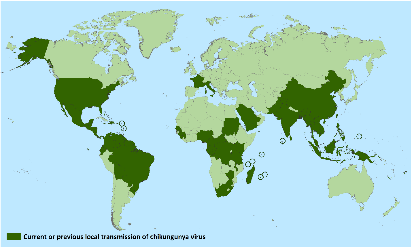
English: Countries and territories where chikungunya cases have been reported* (as of March 10, 2015)
Countries and territories where chikungunya cases have been reported AFRICA
ASIA
EUROPE
AMERICAS
OCEANIA/PACIFIC ISLANDS
|
||
| Date | 03-10-2015 or later | ||
| Source | https://www.cdc.gov/chikungunya/geo/index.html (extracted from https://www.cdc.gov/chikungunya/pdfs/ChikungunyaWorldMap_03-10-2015.pdf) | ||
| Author | CDC | ||
| Permission (Reusing this file) |
|
Licensing
[edit]
This image is a work of the Centers for Disease Control and Prevention, part of the United States Department of Health and Human Services, taken or made as part of an employee's official duties. As a work of the U.S. federal government, the image is in the public domain.
|
File history
Click on a date/time to view the file as it appeared at that time.
| Date/Time | Thumbnail | Dimensions | User | Comment | |
|---|---|---|---|---|---|
| current | 13:22, 12 July 2015 | | 1,430 × 858 (223 KB) | Anka Friedrich (talk | contribs) | {{Information |Description ={{en|1=Countries and territories where chikungunya cases have been reported* (as of March 10, 2015) *Does not include countries or territories where only imported cases have been documented. Countries and territories wh... |
You cannot overwrite this file.
File usage on Commons
There are no pages that use this file.