File:Chart of the eastermost part of the East Indies and China from Cape Comarine to Japan - Title cartouche.jpg

Original file (2,768 × 2,080 pixels, file size: 569 KB, MIME type: image/jpeg)
Captions
Captions
Summary
[edit]| Description |
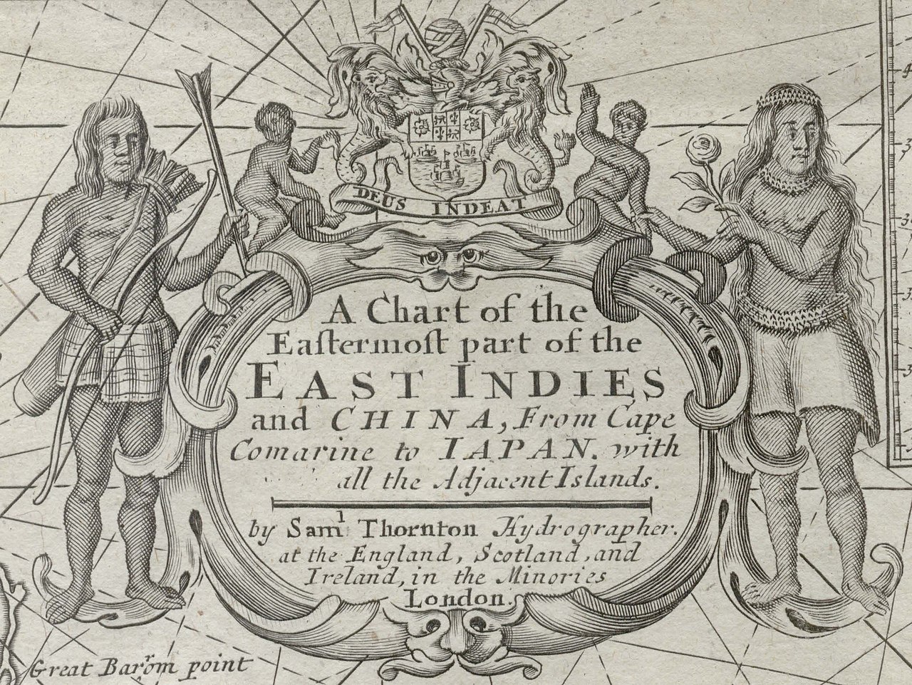
English: This map of China, Japan and Southeast Asia appeared in The English pilot, the third book in 1711, originally published by John Thornton in 1703. Thornton based the 'pilot' upon confidential Dutch manuscript sea-charts, mostly those of Bleau's. Samuel Thornton took over the publication after his father's death in 1708, producing a new edition in 1711. Few changes were made to the actual content of the maps, although John's name was replaced with Samuel's in the cartouche. |
||||||||||||||||||||||
| Date | |||||||||||||||||||||||
| Source | This image is available from the National Library, Singapore's BookSG website: https://eresources.nlb.gov.sg/printheritage/detail/1d3fc72d-a951-4aae-8fb7-294116fcf457.aspx (PDF source) | ||||||||||||||||||||||
| Author |
|
||||||||||||||||||||||
| Other versions | |||||||||||||||||||||||

Licensing
[edit]
This image is in the public domain because it is a mere mechanical scan or photocopy of a public domain original, or – from the available evidence – is so similar to such a scan or photocopy that no copyright protection can be expected to arise. The original itself is in the public domain for the following reason:
This tag is designed for use where there may be a need to assert that any enhancements (eg brightness, contrast, colour-matching, sharpening) are in themselves insufficiently creative to generate a new copyright. It can be used where it is unknown whether any enhancements have been made, as well as when the enhancements are clear but insufficient. For known raw unenhanced scans you can use an appropriate {{PD-old}} tag instead. For usage, see Commons:When to use the PD-scan tag.  | ||||
File history
Click on a date/time to view the file as it appeared at that time.
| Date/Time | Thumbnail | Dimensions | User | Comment | |
|---|---|---|---|---|---|
| current | 00:51, 2 February 2021 | | 2,768 × 2,080 (569 KB) | Ras67 (talk | contribs) | == {{int:filedesc}} == {{Information |description={{en|1=This map of China, Japan and Southeast Asia appeared in The English pilot, the third book in 1711, originally published by John Thornton in 1703. Thornton based the 'pilot' upon confidential Dutch manuscript sea-charts, mostly those of Bleau's. Samuel Thornton took over the publication after his father's death in 1708, producing a new edition in 1711. Few changes were made to the actual content of the maps, although John's name was repl... |
You cannot overwrite this file.
File usage on Commons
The following page uses this file: