File:Charley 2004 rainfall.png
Jump to navigation
Jump to search

Size of this preview: 422 × 599 pixels. Other resolutions: 169 × 240 pixels | 638 × 905 pixels.
Original file (638 × 905 pixels, file size: 24 KB, MIME type: image/png)
Captions
Captions
Add a one-line explanation of what this file represents
Summary
| Description |
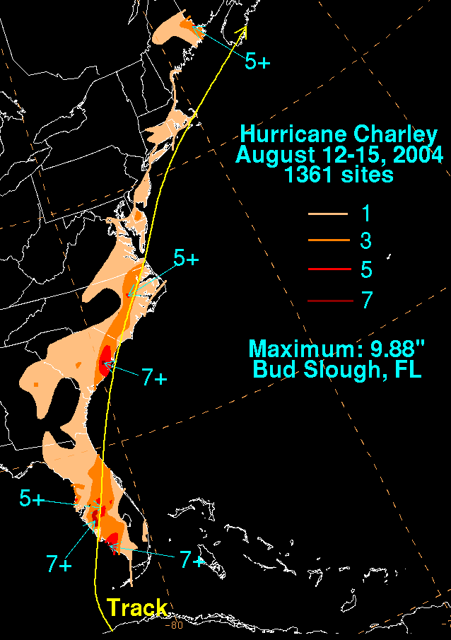
English: Storm total rainfall map of Hurricane Charley during August 2004. |
|||
| Date | ||||
| Source | WPC tropical cyclone rainfall data | |||
| Author | David Roth, Weather Prediction Center, Camp Springs, Maryland | |||
| Permission (Reusing this file) |
|
Original upload log
[edit]
| Date/Time | Dimensions | User | Comment |
|---|---|---|---|
| 12 October 2012, 15:17:59 | 638 × 905 (23693 bytes) | Hurricanefan24 (talk · contribs) | User created page with UploadWizard |
File history
Click on a date/time to view the file as it appeared at that time.
| Date/Time | Thumbnail | Dimensions | User | Comment | |
|---|---|---|---|---|---|
| current | 10:56, 21 November 2014 | | 638 × 905 (24 KB) | GifTagger (talk | contribs) | Bot: Converting file to superior PNG file. (Source: Charley_2004_rainfall.gif). This GIF was problematic due to non-greyscale color table. |
You cannot overwrite this file.
File usage on Commons
The following page uses this file:
- File:Charley 2004 rainfall.gif (file redirect)