File:Charleroi 1933.jpg
Original file (6,835 × 4,668 pixels, file size: 9.22 MB, MIME type: image/jpeg)
Captions
Captions
Summary
[edit]
| Description |
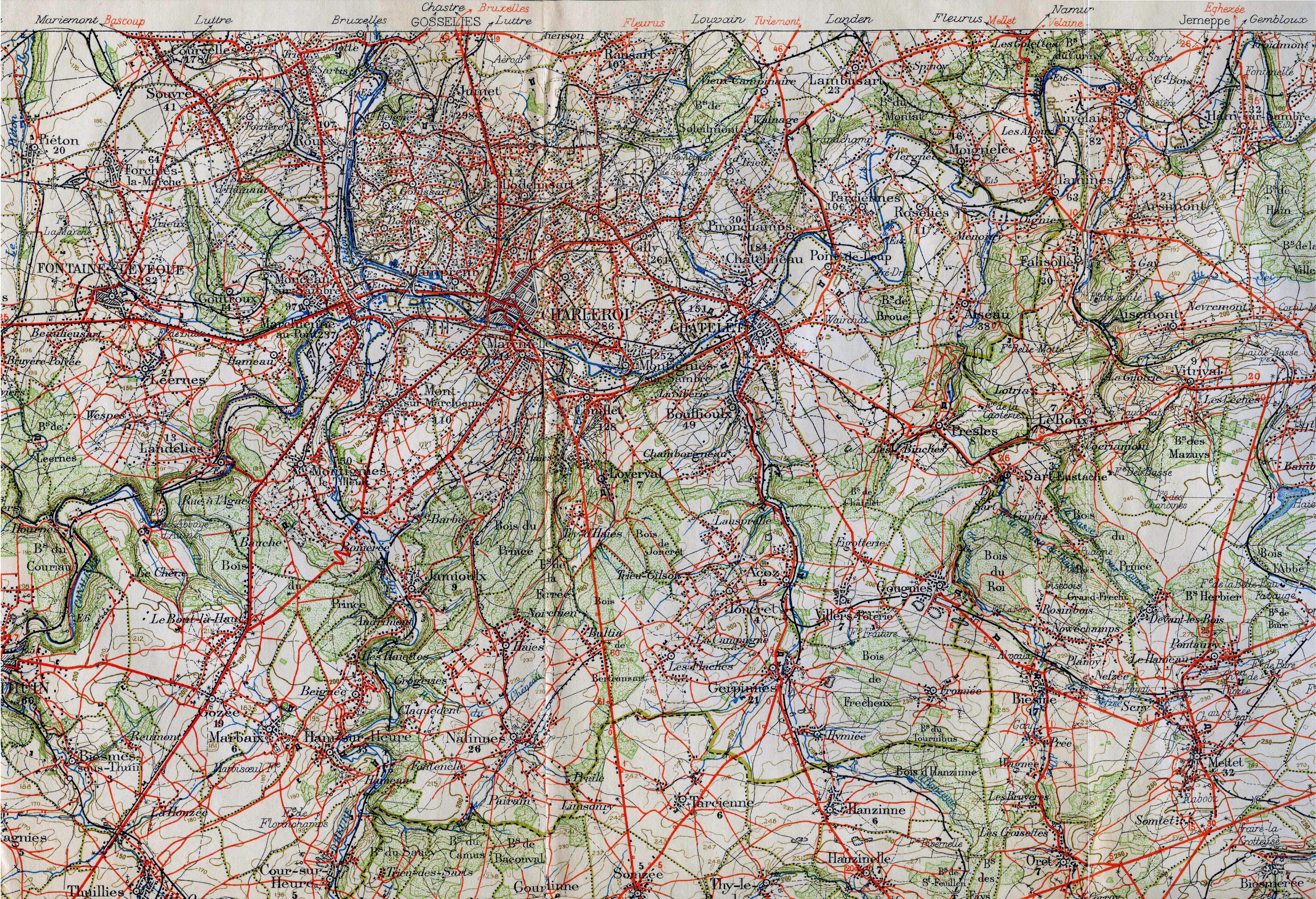
English: Militairy staff map in the area around Charleroi in 1933. It shows the vicinal lines and many railways. This military staff map was cut up and pasted on a canvas.
Railway lines are black lines with marks on one side. Smalltrack is a thinner line. If there are marks on both sides it is double track. After 1933 more vicinal lines where build. Nederlands: Staff kaart rond Charleroi die meerdere buurtspoorweglijnen laat zien, alsmede spoorlijnen. Er komen na 1933 nog meer buurtspoorlijnen. |
| Date | (scanned 2010) |
| Source | Belgian militairy staf map (VII. Mons) |
| Author | L'Institut Cartographique Militaire (Belgian army) |
| This is a retouched picture, which means that it has been digitally altered from its original version. Modifications: removed canvas and joined the three parts, cropped. The original can be viewed here: Charleroi 1933.orig.jpg:
|
Licensing
[edit]
|
This work is in the public domain in its country of origin and other countries and areas where the copyright term is the author's life plus 70 years or fewer.
| |
| This file has been identified as being free of known restrictions under copyright law, including all related and neighboring rights. | |
File history
Click on a date/time to view the file as it appeared at that time.
| Date/Time | Thumbnail | Dimensions | User | Comment | |
|---|---|---|---|---|---|
| current | 15:10, 30 August 2010 | | 6,835 × 4,668 (9.22 MB) | Smiley.toerist (talk | contribs) | {{Information |Description={{en|1=Militairy staff map in the area around Charleroi in 1933. It shows the vicinal lines and many railways. This military staff map was cut up and pasted on a canvas. <br> Railway lines are black lines with marks on one side |
You cannot overwrite this file.
File usage on Commons
There are no pages that use this file.
File usage on other wikis
The following other wikis use this file:
- Usage on nl.wikipedia.org