File:Chapman's map of the Middle (South) Island, c.1860-1869 (16592596960).jpg

Original file (5,186 × 3,254 pixels, file size: 10.6 MB, MIME type: image/jpeg)
Captions
Captions
Summary
[edit]_Island,_c.1860-1869_(16592596960).jpg&action=edit§ion=1)
| Description |
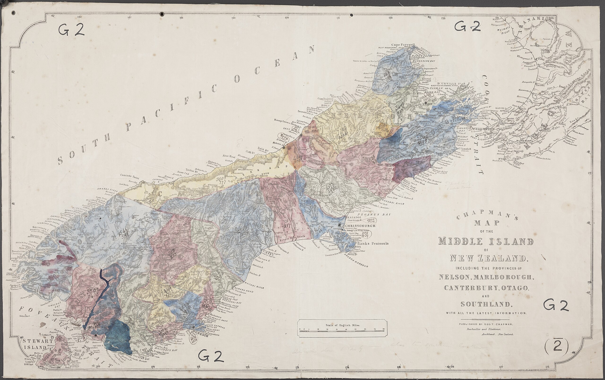
On 5 June 1840, Thomas Bunbury declared British sovereignty over Rakiura (Stewart Island) by right of Captain Cook’s 'discovery'. Bunbury and a number of marines landed near their anchorage at Port Pegasus, where the Union Jack was raised and a proclamation was read. The original copy of the proclamation was then put inside a bottle and buried, while the HMS Herald fired a salute. (In the 1930s author T. Lindsay Buick tried many times to find the bottle, without success). Declaring sovereignty over parts of Aotearoa New Zealand was a course suggested by Secretary of State for the Colonies, Lord Normanby, as well as New South Wales Governor, George Gipps. Captain Joseph Nias of the HMS Herald may have suggested it also, as he was anxious to complete his task of transporting Bunbury south. Twelve days later, Bunbury also declared sovereignty over Te Waipounamu (South Island) by right of cession (www.flickr.com/photos/archivesnz/16688349662). Above is a lithographic map of the South (Middle) Island and Stewart Island, drawn by J. Wareham and published by George T. Chapman c.1860-1869. It comes from a series of maps which came into the possession of the Statutory Branch of the Department of Survey and Land Information. The map has been coloured by hand, but there is no key to indicate what the colours are for. Archives Reference: AAFV 997 Box 34/ G2 [B] archway.archives.govt.nz/ViewFullItem.do?code=22823150 This record is part of #Waitangi175, celebrating 175 years since the signing of of te Tiriti o Waitangi. You can see other real time tweets on Twitter (twitter.com/ArchivesNZ), or explore the Waitangi 175 album here on Flickr. Material supplied by Archives New Zealand Caption information from Claudia Orange, 'The Treaty of Waitangi' |
| Date | |
| Source | Chapman's map of the Middle [South] Island, c.1860-1869 |
| Author | Archives New Zealand from New Zealand |
Licensing
[edit]_Island,_c.1860-1869_(16592596960).jpg&action=edit§ion=2)
- You are free:
- to share – to copy, distribute and transmit the work
- to remix – to adapt the work
- Under the following conditions:
- attribution – You must give appropriate credit, provide a link to the license, and indicate if changes were made. You may do so in any reasonable manner, but not in any way that suggests the licensor endorses you or your use.
- share alike – If you remix, transform, or build upon the material, you must distribute your contributions under the same or compatible license as the original.
| This image was originally posted to Flickr by Archives New Zealand at https://flickr.com/photos/35759981@N08/16592596960. It was reviewed on 8 September 2016 by FlickreviewR and was confirmed to be licensed under the terms of the cc-by-sa-2.0. |
File history
Click on a date/time to view the file as it appeared at that time.
| Date/Time | Thumbnail | Dimensions | User | Comment | |
|---|---|---|---|---|---|
| current | 21:11, 8 September 2016 | | 5,186 × 3,254 (10.6 MB) | Vanished Account Byeznhpyxeuztibuo (talk | contribs) | Transferred from Flickr via Flickr2Commons |
You cannot overwrite this file.
File usage on Commons
There are no pages that use this file.
_Island,_c.1860-1869_(16592596960).jpg&oldid=888310594)