File:Channels in the mudflats - geograph.org.uk - 332755.jpg
Jump to navigation
Jump to search
No higher resolution available.
Channels_in_the_mudflats_-_geograph.org.uk_-_332755.jpg (640 × 480 pixels, file size: 92 KB, MIME type: image/jpeg)
Captions
Captions
Add a one-line explanation of what this file represents
Summary
[edit]
| Description |
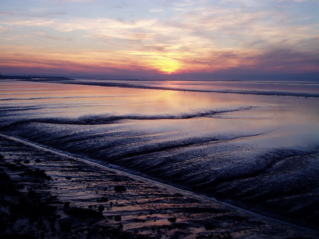
English: Channels in the mudflats This particular stretch of mudflats drains inland, with a rather straight channel carrying the water back to the river. I'm not sure of the explanation for this natural phenomenon, but I suspect it might be that when the river floods, it deposits the largest load of silt at the point closest to where it bursts its banks. (This is certainly the reason why levees form along rivers prone to flooding.) The sun can be seen setting behind the Forest of Dean. |
| Date | |
| Source | From geograph.org.uk |
| Author | David Gruar |
| Attribution (required by the license) | David Gruar / Channels in the mudflats / |
| Object location | | View this and other nearby images on: OpenStreetMap |
|---|
_heading:247.00&language=en)
Licensing
[edit]

|
This image was taken from the Geograph project collection. See this photograph's page on the Geograph website for the photographer's contact details. The copyright on this image is owned by David Gruar and is licensed for reuse under the Creative Commons Attribution-ShareAlike 2.0 license.
|
This file is licensed under the Creative Commons Attribution-Share Alike 2.0 Generic license.
Attribution: David Gruar
- You are free:
- to share – to copy, distribute and transmit the work
- to remix – to adapt the work
- Under the following conditions:
- attribution – You must give appropriate credit, provide a link to the license, and indicate if changes were made. You may do so in any reasonable manner, but not in any way that suggests the licensor endorses you or your use.
- share alike – If you remix, transform, or build upon the material, you must distribute your contributions under the same or compatible license as the original.
File history
Click on a date/time to view the file as it appeared at that time.
| Date/Time | Thumbnail | Dimensions | User | Comment | |
|---|---|---|---|---|---|
| current | 21:28, 30 December 2010 | | 640 × 480 (92 KB) | GeographBot (talk | contribs) | == {{int:filedesc}} == {{Information |description={{en|1=Channels in the mudflats This particular stretch of mudflats drains inland, with a rather straight channel carrying the water back to the river. I'm not sure of the explanation for this natural phen |
You cannot overwrite this file.
File usage on Commons
There are no pages that use this file.