File:Channel Islands NMS map.jpg
Jump to navigation
Jump to search
Size of this preview: 774 × 600 pixels. Other resolutions: 310 × 240 pixels | 619 × 480 pixels | 991 × 768 pixels | 1,280 × 992 pixels | 2,000 × 1,550 pixels.
Original file (2,000 × 1,550 pixels, file size: 637 KB, MIME type: image/jpeg)
Captions
Captions
Add a one-line explanation of what this file represents
Summary
[edit]
| Description |
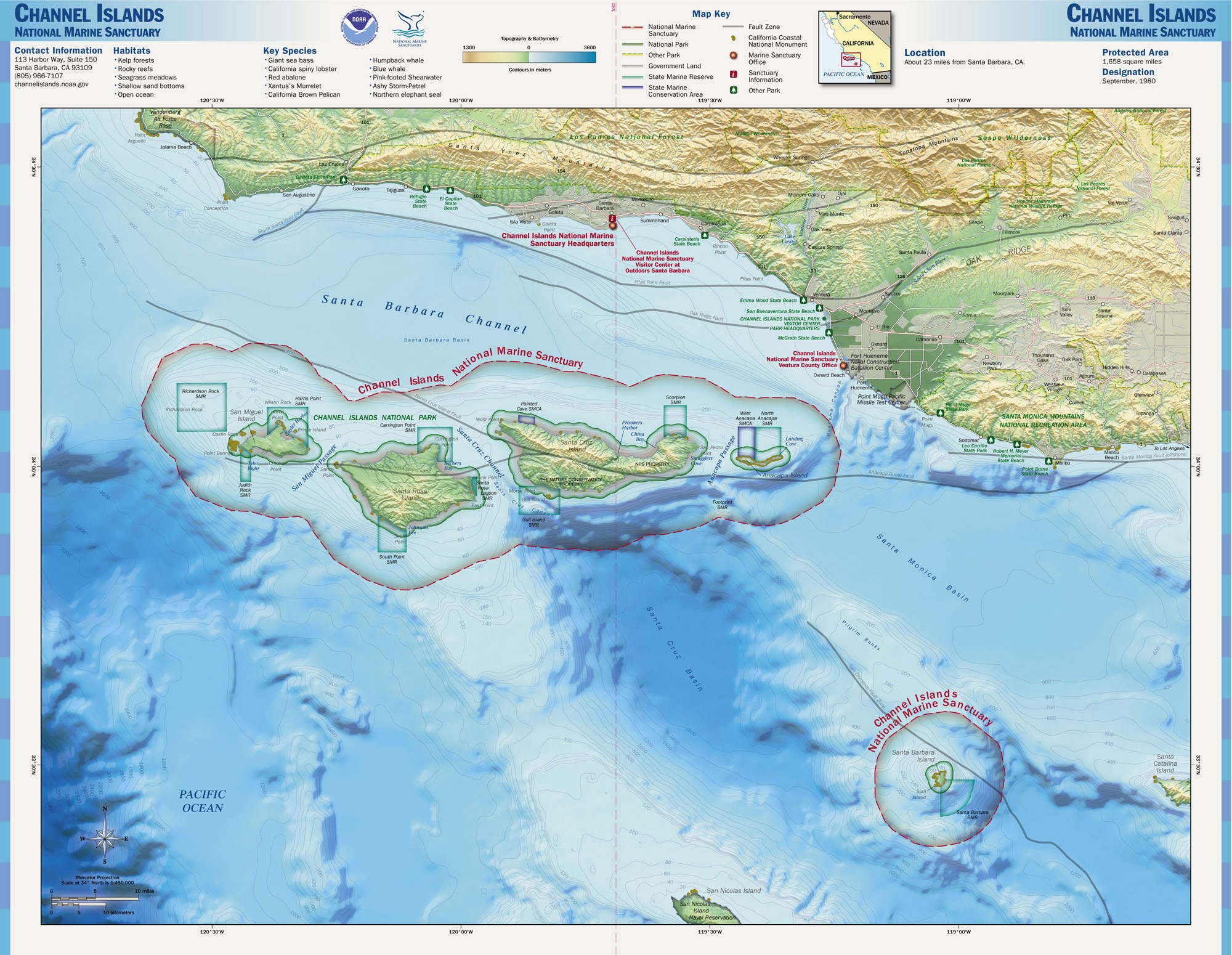
English: Map of the Channel Islands National Marine Sanctuary — Southern California.
|
|||
| Source | http://www.sanctuaries.noaa.gov/pgallery/atlasmaps/ci.html | |||
| Author | NOAA, National Marine Sanctuaries | |||
| Permission (Reusing this file) |
|
File history
Click on a date/time to view the file as it appeared at that time.
| Date/Time | Thumbnail | Dimensions | User | Comment | |
|---|---|---|---|---|---|
| current | 01:34, 17 October 2006 | | 2,000 × 1,550 (637 KB) | Davepape (talk | contribs) | {{Information |Description=Map of the Channel Islands National Marine Sanctuary |Source=http://www.sanctuaries.noaa.gov/pgallery/atlasmaps/ci.html |Date= |Author=NOAA, National Marine Sanctuaries |Permissi |
You cannot overwrite this file.
File usage on Commons
The following page uses this file:
File usage on other wikis
The following other wikis use this file:
- Usage on de.wikipedia.org
- Usage on en.wikipedia.org
- Usage on es.wikipedia.org
- Usage on fr.wikipedia.org
- Usage on www.wikidata.org