File:Chan Chich Site Map.png
Jump to navigation
Jump to search
Size of this preview: 777 × 599 pixels. Other resolutions: 311 × 240 pixels | 622 × 480 pixels | 996 × 768 pixels | 1,280 × 987 pixels | 1,430 × 1,103 pixels.
Original file (1,430 × 1,103 pixels, file size: 206 KB, MIME type: image/png)
Captions
Captions
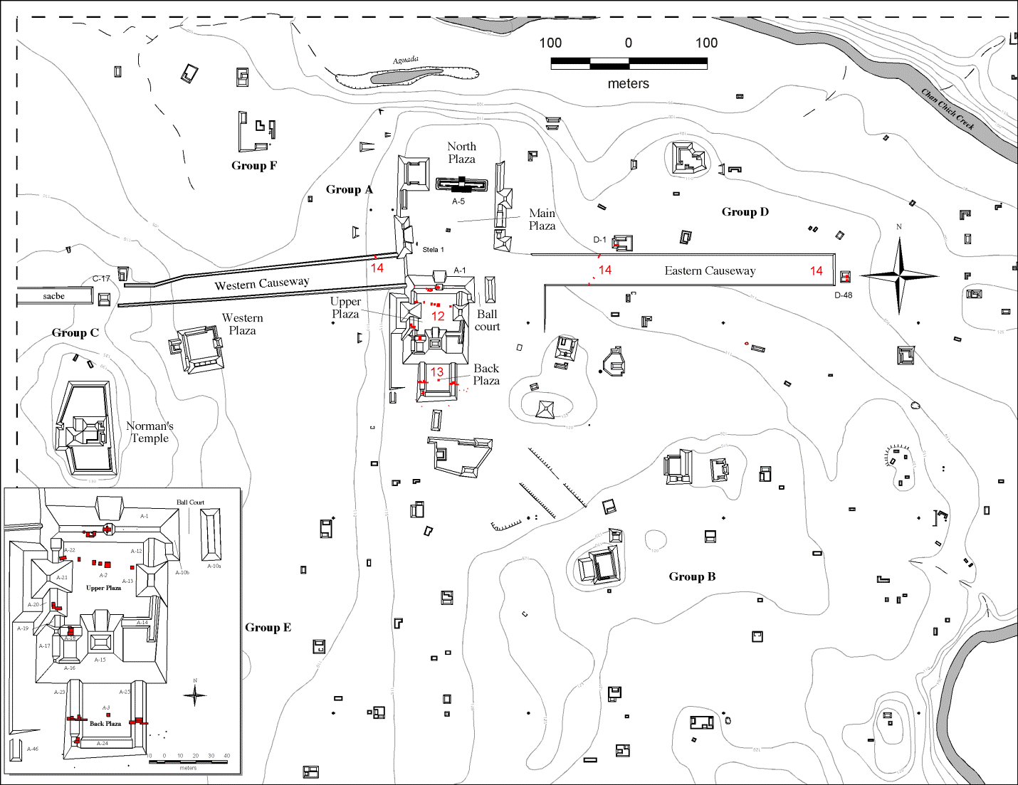
Chan Chich Site Map
Summary
[edit]
| Description |
English: This is the map for the Archaeological Site, Chan Chich |
| Date | |
| Source | INVESTIGATING URBAN FORM AND KINGSHIP: PRELIMINARY RESULTS OF THE 2014 CHAN CHICH ARCHAEOLOGICAL PROJECT |
| Author | Kelsey E. Herndon, Gregory Zaro, Brett A. Houk, David Sandrock, Ashley Booher and Edgar Vasquez |
Licensing
[edit]
| This file is made available under the Creative Commons CC0 1.0 Universal Public Domain Dedication. | |
| The person who associated a work with this deed has dedicated the work to the public domain by waiving all of their rights to the work worldwide under copyright law, including all related and neighboring rights, to the extent allowed by law. You can copy, modify, distribute and perform the work, even for commercial purposes, all without asking permission.
|
File history
Click on a date/time to view the file as it appeared at that time.
| Date/Time | Thumbnail | Dimensions | User | Comment | |
|---|---|---|---|---|---|
| current | 04:52, 29 July 2020 | | 1,430 × 1,103 (206 KB) | RememeberThePlacidium (talk | contribs) | Uploaded a work by Kelsey E. Herndon, Gregory Zaro, Brett A. Houk, David Sandrock, Ashley Booher and Edgar Vasquez from INVESTIGATING URBAN FORM AND KINGSHIP: PRELIMINARY RESULTS OF THE 2014 CHAN CHICH ARCHAEOLOGICAL PROJECT with UploadWizard |
You cannot overwrite this file.
File usage on Commons
There are no pages that use this file.
File usage on other wikis
The following other wikis use this file:
- Usage on en.wikipedia.org