File:Chan-hom 2009-05-04 0930Z.jpg
Jump to navigation
Jump to search
Size of this preview: 600 × 600 pixels. Other resolutions: 240 × 240 pixels | 480 × 480 pixels | 768 × 768 pixels | 1,024 × 1,024 pixels.
Original file (1,024 × 1,024 pixels, file size: 142 KB, MIME type: image/jpeg)
Captions
Captions
Add a one-line explanation of what this file represents
Summary
[edit]
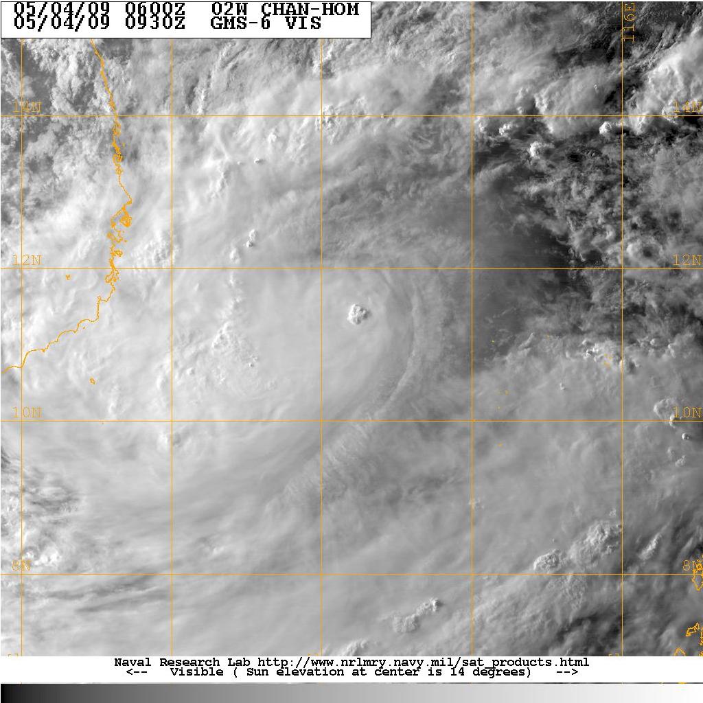
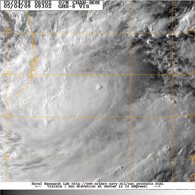
| Description | On May 2, an area of covection cloudiness associated with an area of disturbed weather formed southeast of Nha Trang, Vietnam and associated with remnant of Tropical depression Crising. JTWC monitored the low as "Fair" for developing due to low vertical wind shear and an upper level anticyclone to the east of the system. Later on the JMA designated the low pressure as a minor tropical depression reporting the outlook track as southwestward. The JTWC issued a TCFA on the system once the convection increased and became better organized although with an exposed LLC east of its convection. Early morning of May 3, the JMA begun issuing tropical cyclone advisories on the system forecasting it to become a tropical storm later in the afternoon as it tracks eastwards. On May 3, the JTWC desingated disturbance as Tropical Depression 02W as the JMA named the storm Chan-hom. As the storm moved into PAGASA's area of responsibility, they gave it the name "Emong". |
| Date | |
| Source | http://199.9.2.143/tc-bin/tc_home2.cgi?ACTIVES=09-SHEM-05S.BILLY,09-SHEM-94S.INVEST,09-WPAC-99W.INVEST&SIZE=Thumb&PHOT=yes&NAV=tc&YR=09&ATCF_BASIN=wp&ATCF_YR=1&YEAR=2009&ATCF_FILE=1/&CURRENT=20090103.1457.gms6.x.ir1km_bw.99WINVEST.15kts-1008mb-89N-1271E.100pc.jpg&AGE=Latest&ATCF_NAME=wp991&ATCF_DIR=1&ARCHIVE=active&MO=MAY&BASIN=WPAC&STORM_NAME=02W.CHAN-HOM&STYLE=tables&AREA=atlantic/tropics&AID_DIR=/data/www/pacific/western/tropics/microvap/dmsp&DIR=/TC/tc09/WPAC/02W.CHAN-HOM/vis/geo/1km_zoom&TYPE=geo&PROD=vis&SUB_PROD=1km_zoom |
| Author | NRL/Navy |
Licensing
[edit]
This file is a work of a sailor or employee of the U.S. Navy, taken or made as part of that person's official duties. As a work of the U.S. federal government, it is in the public domain in the United States.
|
 | |
| This file has been identified as being free of known restrictions under copyright law, including all related and neighboring rights. | ||
File history
Click on a date/time to view the file as it appeared at that time.
| Date/Time | Thumbnail | Dimensions | User | Comment | |
|---|---|---|---|---|---|
| current | 14:47, 4 May 2009 | | 1,024 × 1,024 (142 KB) | Jpuligan 12 (talk | contribs) | {{Information |Description=On May 2, an area of covection cloudiness associated with an area of disturbed weather formed southeast of Nha Trang, Vietnam and associated with remnant of Tropical depression Crising. JTWC monitored the low as "Fair" for devel |
You cannot overwrite this file.
File usage on Commons
The following page uses this file:
- File:TYPHOON CHAN-HOM.jpg (file redirect)
File usage on other wikis
The following other wikis use this file:
- Usage on zh.wikipedia.org