File:Chambolle-Musigny Eglise R01.jpg
From Wikimedia Commons, the free media repository
Jump to navigation
Jump to search
Size of this preview: 800 × 570 pixels. Other resolutions: 320 × 228 pixels | 640 × 456 pixels | 1,024 × 729 pixels | 1,280 × 911 pixels | 2,560 × 1,823 pixels | 4,862 × 3,462 pixels.
Original file (4,862 × 3,462 pixels, file size: 12.55 MB, MIME type: image/jpeg)
File information
Structured data
Captions
Summary
[edit]DescriptionChambolle-Musigny Eglise R01.jpg |
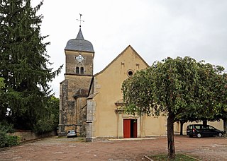
Nederlands: Chambolle-Musigny (departement Côte-d'Or, Frankrijk): de Sint-Barbara- en Sint-Sebastianuskerk
English: Chambolle-Musigny (Côte-d'Or department, France): St Barbara and St Sebastian's church
Français : Chambolle-Musigny (département de la Côte-d'Or, France) : l'église Saint-Barbe-et-Saint-Sébastien
|
|||
Date | ||||
Source | Own work | |||
Author | Marc Ryckaert |
Camera location | 47° 11′ 06.58″ N, 4° 57′ 03.72″ E | View this and other nearby images on: OpenStreetMap | 47.185160; 4.951032 |
---|
Licensing
[edit]I, the copyright holder of this work, hereby publish it under the following license:
This file is licensed under the Creative Commons Attribution-Share Alike 4.0 International license.
- You are free:
- to share – to copy, distribute and transmit the work
- to remix – to adapt the work
- Under the following conditions:
- attribution – You must give appropriate credit, provide a link to the license, and indicate if changes were made. You may do so in any reasonable manner, but not in any way that suggests the licensor endorses you or your use.
- share alike – If you remix, transform, or build upon the material, you must distribute your contributions under the same or compatible license as the original.
File history
Click on a date/time to view the file as it appeared at that time.
Date/Time | Thumbnail | Dimensions | User | Comment | |
---|---|---|---|---|---|
current | 20:27, 8 October 2017 | 4,862 × 3,462 (12.55 MB) | MJJR (talk | contribs) | User created page with UploadWizard |
You cannot overwrite this file.
File usage on Commons
There are no pages that use this file.
File usage on other wikis
The following other wikis use this file:
- Usage on de.wikipedia.org
- Usage on fr.wikipedia.org
Metadata
This file contains additional information such as Exif metadata which may have been added by the digital camera, scanner, or software program used to create or digitize it. If the file has been modified from its original state, some details such as the timestamp may not fully reflect those of the original file. The timestamp is only as accurate as the clock in the camera, and it may be completely wrong.
Camera manufacturer | Canon |
---|---|
Camera model | Canon EOS 6D |
Author | Marc Ryckaert |
Exposure time | 1/250 sec (0.004) |
F-number | f/9 |
ISO speed rating | 200 |
Date and time of data generation | 15:02, 31 August 2017 |
Lens focal length | 24 mm |
Latitude | 47° 11′ 6.58″ N |
Longitude | 4° 57′ 3.71″ E |
Altitude | 286.6 meters above sea level |
Orientation | Normal |
Horizontal resolution | 350 dpi |
Vertical resolution | 350 dpi |
Software used | Adobe Photoshop Elements 6.0 Macintosh |
File change date and time | 22:21, 8 October 2017 |
Y and C positioning | Centered |
Exif version | 2.3 |
Date and time of digitizing | 15:02, 31 August 2017 |
Meaning of each component |
|
APEX shutter speed | 8 |
APEX aperture | 6.375 |
APEX exposure bias | 0 |
Flash | Flash did not fire, compulsory flash suppression |
Supported Flashpix version | 1 |
Color space | sRGB |
Focal plane X resolution | 3,810.5849582173 |
Focal plane Y resolution | 3,815.89958159 |
Focal plane resolution unit | inches |
Custom image processing | Normal process |
Exposure mode | Auto exposure |
White balance | Auto white balance |
Scene capture type | Standard |
GPS time (atomic clock) | 12:58 |
Satellites used for measurement | 12 |
Receiver status | Measurement in progress |
Geodetic survey data used | WGS-84 |
GPS date | 31 August 2017 |
GPS tag version | 0.0.3.2 |
Supported Flashpix version | 1 |
Image width | 4,862 px |
Image height | 3,462 px |
Rating (out of 5) | 0 |
Date metadata was last modified | 00:21, 9 October 2017 |
Structured data
Items portrayed in this file
depicts
some value
some value
47°11'6.576"N, 4°57'3.715"E
31 August 2017
image/jpeg
647c77e6c32870b032c3fa39602870c108b667c7
13,159,427 byte
3,462 pixel
4,862 pixel
Hidden categories:
- Base Mérimée
- Monuments historiques inscrits
- Monuments historiques classés
- Mérimée with PA parameter
- Cultural heritage monuments in France with known IDs
- Cultural heritage monuments in France missing SDC depicts
- Cultural heritage monuments in France missing SDC location of creation
- Files with coordinates missing SDC location of creation
- CC-BY-SA-4.0
- Self-published work
- Taken with Canon EOS 6D
- Images by MJJR