File:Chamba Kangra Bilaspur Mandi Kulu 1911.jpeg
Jump to navigation
Jump to search
Size of this preview: 511 × 600 pixels. Other resolutions: 204 × 240 pixels | 409 × 480 pixels | 744 × 873 pixels.
Original file (744 × 873 pixels, file size: 130 KB, MIME type: image/jpeg)
Captions
Captions
Add a one-line explanation of what this file represents
Summary
[edit]| Description |
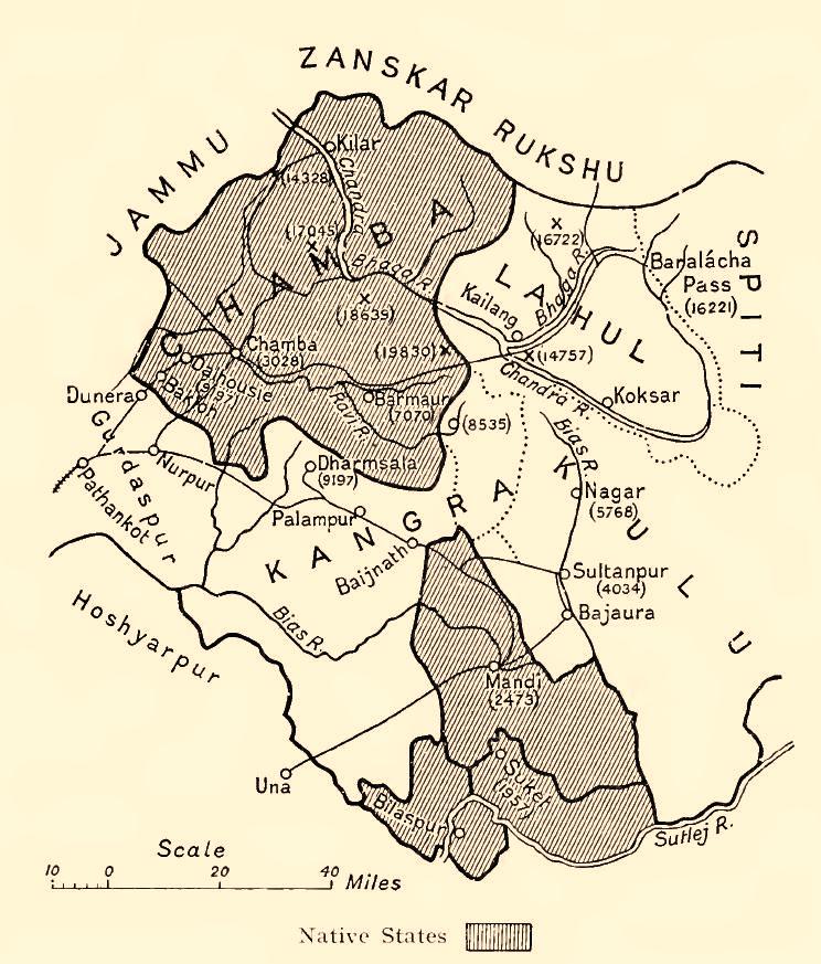
English: Map of some Indian princely states in the "Shimla Hill/Punjab Hill Agency" amongst them Chamba, Kangra, Bilaspur (= Khalur), Mandi, Kulu, 1911
Deutsch: Karte einiger kleinerer indischer Fürstenstaaten in der "Shimla Hill/Punjab Hill Agency" unter anderem Chamba, Kangra, Bilaspur(= Khalur), Mandi, Kulu, 1911 |
| Date | |
| Source | Provincial Geographies of India , Vol. III |
| Author | Holland, Thomas H. (Thomas Henry), Sir |


Licensing
[edit]
|
This work is in the public domain in its country of origin and other countries and areas where the copyright term is the author's life plus 70 years or fewer. | |
| This file has been identified as being free of known restrictions under copyright law, including all related and neighboring rights. | |
File history
Click on a date/time to view the file as it appeared at that time.
| Date/Time | Thumbnail | Dimensions | User | Comment | |
|---|---|---|---|---|---|
| current | 02:03, 29 June 2014 | | 744 × 873 (130 KB) | Xufanc (talk | contribs) | Sepia tone |
| 15:30, 18 January 2010 |  | 744 × 873 (123 KB) | Zenwort (talk | contribs) | {{Information |Description={{en|1=Map of some Indian princely states in the "Shimla Hill/Punjab Hill Agency" amongst them Chamba, Kangra, Bilaspur (= Khalur), Mandi, Kulu, 1911}} {{de|1=Karte einiger kleinerer indischer Fürstenstaaten in der "Shimla Hill |
You cannot overwrite this file.
File usage on Commons
The following 2 pages use this file:
File usage on other wikis
The following other wikis use this file:
- Usage on br.wikipedia.org
- Usage on ca.wikipedia.org
- Usage on de.wikipedia.org
- Usage on en.wikipedia.org
- Usage on hi.wikipedia.org
- Usage on it.wikipedia.org
- Usage on or.wikipedia.org
- Usage on pnb.wikipedia.org
- Usage on ru.wikipedia.org
- Usage on simple.wikipedia.org
- Usage on ta.wikipedia.org
- Usage on ur.wikipedia.org
- Usage on www.wikidata.org