File:Chaba 2004-08-29 0458Z.jpg
Jump to navigation
Jump to search
Size of this preview: 638 × 600 pixels. Other resolutions: 255 × 240 pixels | 511 × 480 pixels | 817 × 768 pixels | 1,277 × 1,200 pixels.
Original file (1,277 × 1,200 pixels, file size: 552 KB, MIME type: image/jpeg)
Captions
Captions
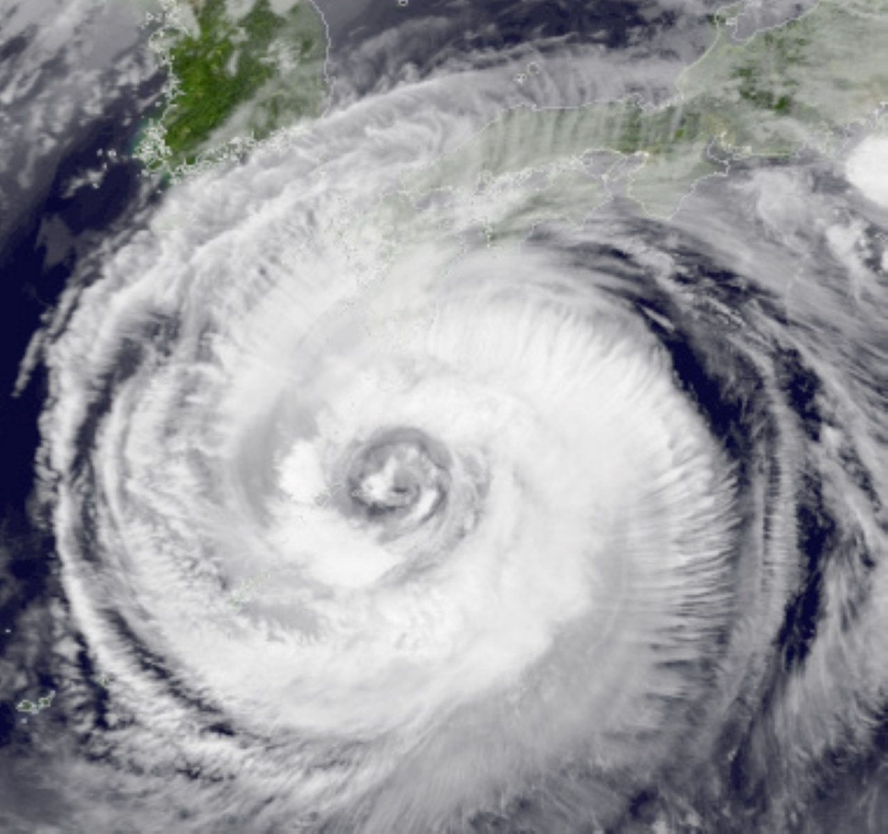
Typhoon Chaba near Japan as a Category 3. The storm was captured on https://worldview.earthdata.nasa.gov/ with band 31 infared imagery on Nasa's Aqua (Day) Imagery at 0000 UTC.
Summary
[edit]
| Description |
English: Typhoon Chaba near Japan as a Category 3. The storm was captured on https://worldview.earthdata.nasa.gov/ with band 31 infared imagery on Nasa's Aqua (Day) Imagery at 0000 UTC. Land Imagery comes from Nasa's Blue Marble Imagery found at https://visibleearth.nasa.gov/images/57752/blue-marble-land-surface-shallow-water-and-shaded-topography |
| Date | |
| Source | Land Imagery comes from https://visibleearth.nasa.gov/images/57752/blue-marble-land-surface-shallow-water-and-shaded-topography and satellite imagery comes from https://wvs.earthdata.nasa.gov/api/v1/snapshot?REQUEST=GetSnapshot&TIME=2004-08-29T00:00:00Z&BBOX=21.95987166996909,123.31350277682866,37.553038025358624,139.8895433317913&CRS=EPSG:4326&LAYERS=MODIS_Terra_Brightness_Temp_Band31_Day,Coastlines&WRAP=day,x&FORMAT=image/jpeg&WIDTH=1886&HEIGHT=1774&ts=1607506164458 |
| Author | Nasa made the Land Imagery and Satellite Imagery |
Licensing
[edit]
| This file is in the public domain in the United States because it was solely created by NASA. NASA copyright policy states that "NASA material is not protected by copyright unless noted". (See Template:PD-USGov, NASA copyright policy page or JPL Image Use Policy.) | ||
 |
Warnings:
|
File history
Click on a date/time to view the file as it appeared at that time.
| Date/Time | Thumbnail | Dimensions | User | Comment | |
|---|---|---|---|---|---|
| current | 04:56, 10 December 2020 | | 1,277 × 1,200 (552 KB) | Sanvid2395 (talk | contribs) | Uploaded a work by Nasa made the Land Imagery and Satellite Imagery from Land Imagery comes from https://visibleearth.nasa.gov/images/57752/blue-marble-land-surface-shallow-water-and-shaded-topography and satellite imagery comes from https://wvs.earthdata.nasa.gov/api/v1/snapshot?REQUEST=GetSnapshot&TIME=2004-08-29T00:00:00Z&BBOX=21.95987166996909,123.31350277682866,37.553038025358624,139.8895433317913&CRS=EPSG:4326&LAYERS=MODIS_Terra_Brightness_Temp_Band31_Day,Coastlines&WRAP=day,x&FORMAT=im... |
You cannot overwrite this file.
File usage on Commons
The following page uses this file:
- File:Typhoon Chaba Near Japan August 29th 2004 0000Z.jpg (file redirect)
File usage on other wikis
The following other wikis use this file:
- Usage on ar.wikipedia.org
- Usage on incubator.wikimedia.org
- Usage on www.wikidata.org