File:Châteaudun (Eure-et-Loir) (15359815655).jpg

Original file (3,480 × 2,720 pixels, file size: 5.4 MB, MIME type: image/jpeg)
Captions
Captions
Summary
[edit]_(15359815655).jpg&action=edit§ion=1)
| Description |
Français : Châteaudun (Eure-et-Loir)
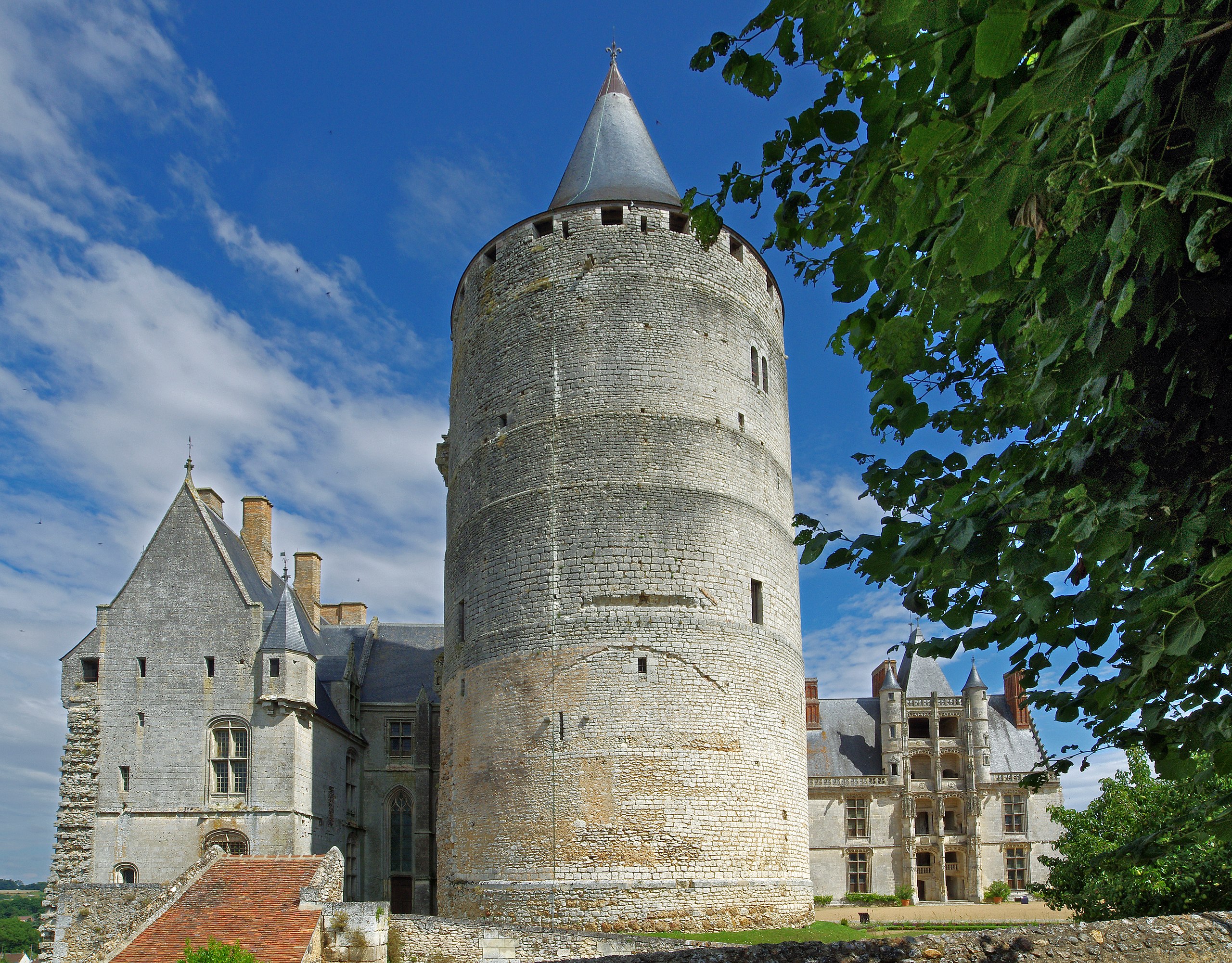
Le château. La grosse tour ou donjon a été construite à la fin du XIIème siècle par Thibaud V. C'est la seule partie du château d'origine des comtes de Blois. La tour a été couverte d'une charpente en 1450 par Dunois. C'est l'un des donjons les mieux conservés de France. Les sous-sols de la tour ont servi de prison pendant la période révolutionnaire. A droite, l'aile Longueville est édifiée sous François II de Longueville, petit fils de Dunois, à partir de 1510. Le grand escalier Renaissance, bâti dans l'angle nord-ouest, est couvert d'un haut toit et flanqué de deux tourelles. L'escalier s'inspire du quattrocento italien. A gauche, l'aile Dunois du XV ème siècle.English: Châteaudun (Eure-et-Loir)
The great tower or keep was built in the late twelfth century by Thibaud V. This is the only part of the original castle of the Counts of Blois. The tower was covered by a conical roof in 1450 by Dunois. This is one of the best preserved of France dungeon.The basement of the tower served as a prison during the Revolution. Right, Longueville wing is built under François II de Longueville, grand-son of Dunois, from 1510. The great Renaissance staircase, built in the northwest corner, is covered with a high roof and flanked by two turrets. The staircase is inspired by the Italian Quattrocento. Left, Dunois wing of the fifteenth century. |
| Date | Taken on 22 July 2014, 11:47 |
| Source | Châteaudun (Eure-et-Loir) |
| Author | Daniel Jolivet |
| Camera location | | View this and other nearby images on: OpenStreetMap |
|---|
_(15359815655).jpg¶ms=048.070311_N_0001.323719_E_globe:Earth_type:camera_source:Flickr_&language=en)
Licensing
[edit]_(15359815655).jpg&action=edit§ion=2)
- You are free:
- to share – to copy, distribute and transmit the work
- to remix – to adapt the work
- Under the following conditions:
- attribution – You must give appropriate credit, provide a link to the license, and indicate if changes were made. You may do so in any reasonable manner, but not in any way that suggests the licensor endorses you or your use.
| This image was originally posted to Flickr by sybarite48 at https://flickr.com/photos/26082117@N07/15359815655 (archive). It was reviewed on 17 November 2017 by FlickreviewR 2 and was confirmed to be licensed under the terms of the cc-by-2.0. |
File history
Click on a date/time to view the file as it appeared at that time.
| Date/Time | Thumbnail | Dimensions | User | Comment | |
|---|---|---|---|---|---|
| current | 14:12, 17 November 2017 | | 3,480 × 2,720 (5.4 MB) | Thesupermat2 (talk | contribs) | Transferred from Flickr via Flickr2Commons |
You cannot overwrite this file.
File usage on Commons
There are no pages that use this file.
File usage on other wikis
The following other wikis use this file:
- Usage on fr.wikipedia.org
_(15359815655).jpg&oldid=860729703)