File:Château des Rohan, Saverne fisheye-MJ.jpg
Jump to navigation
Jump to search
Size of this preview: 799 × 227 pixels. Other resolutions: 320 × 91 pixels | 640 × 182 pixels | 1,024 × 291 pixels | 3,540 × 1,006 pixels.
Original file (3,540 × 1,006 pixels, file size: 1.75 MB, MIME type: image/jpeg)
Captions
Captions
Add a one-line explanation of what this file represents
Summary
[edit]
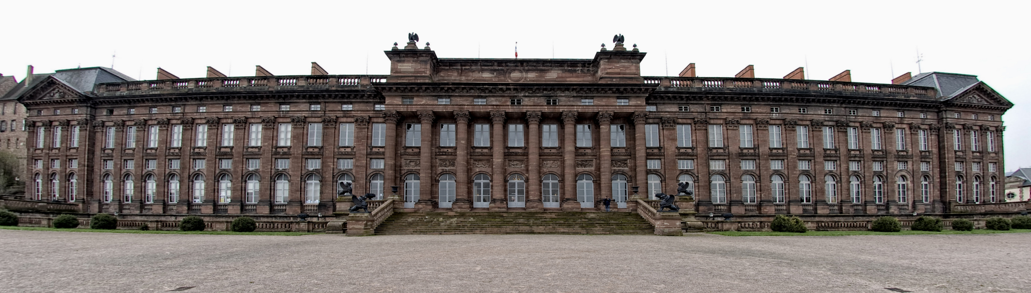
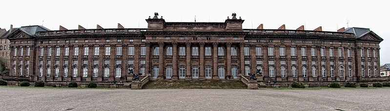
Bearbeitete Version von File:Château des Rohan, Saverne fisheye.jpg durch Mirko Junge
| Description | Palais Rohan |
| Date | |
| Source | Saverne |
| Author | pommes.fritz123 from Germany |
| Camera location | | View this and other nearby images on: OpenStreetMap |
|---|
Licensing
[edit]
This file is licensed under the Creative Commons Attribution-Share Alike 2.0 Generic license.
- You are free:
- to share – to copy, distribute and transmit the work
- to remix – to adapt the work
- Under the following conditions:
- attribution – You must give appropriate credit, provide a link to the license, and indicate if changes were made. You may do so in any reasonable manner, but not in any way that suggests the licensor endorses you or your use.
- share alike – If you remix, transform, or build upon the material, you must distribute your contributions under the same or compatible license as the original.
| This image was originally posted to Flickr by pommes.fritz123 at https://www.flickr.com/photos/21058827@N06/4521446214. It was reviewed on 26 November 2010 by FlickreviewR and was confirmed to be licensed under the terms of the cc-by-sa-2.0. |

Fotowerkstatt
| Editor: Mirko Junge | |
| Changes: optical distortion reduced, levels corrected, sharpend. | |
This picture was reworked by the Fotowerkstatt. You can propose images to improve as well.
File history
Click on a date/time to view the file as it appeared at that time.
| Date/Time | Thumbnail | Dimensions | User | Comment | |
|---|---|---|---|---|---|
| current | 00:47, 28 November 2010 | 3,540 × 1,006 (1.75 MB) | DrJunge (talk | contribs) | tilt eliminated. | |
| 00:39, 28 November 2010 | 3,651 × 1,051 (2.08 MB) | DrJunge (talk | contribs) | Fisheye distortion reduced. | ||
| 16:08, 27 November 2010 | 3,663 × 1,240 (2.91 MB) | DrJunge (talk | contribs) | Bearbeitete Version von File:Château des Rohan, Saverne fisheye.jpg durch Mirko Junge<br> {{Information |Description=Palais Rohan |Source=[http://www.flickr.com/photos/21058827@N06/4521446214/ Saverne] |Date=2010-04-10 09:3 |
You cannot overwrite this file.
File usage on Commons
There are no pages that use this file.
File usage on other wikis
The following other wikis use this file:
- Usage on de.wikipedia.org