File:Centre Old Luhansk Map 1879.jpg
Jump to navigation
Jump to search

Size of this preview: 483 × 599 pixels. Other resolutions: 193 × 240 pixels | 387 × 480 pixels | 619 × 768 pixels | 826 × 1,024 pixels | 1,840 × 2,282 pixels.
Original file (1,840 × 2,282 pixels, file size: 3.1 MB, MIME type: image/jpeg)
Captions
Captions
Add a one-line explanation of what this file represents
Summary
[edit]
| Description |
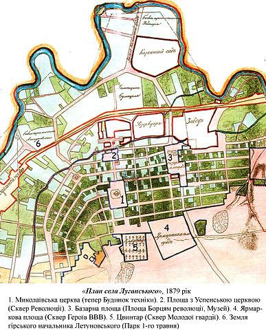
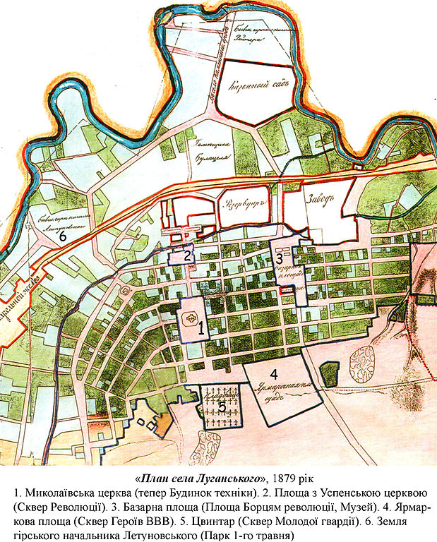
Українська: «План села Луганського», 1879 рік. 1) Миколаївська церква (тепер Будинок техніки). 2) Площа з Успенською церквою (Сквер Революції). 3) Базарна площа (Площа Борцям революції, Музей). 4) Ярмаркова площа (Сквер Героїв ВВВ). 5) Цвинтар (Сквер Молодої гвардії ). 6) Земля гірського начальника Летуновського (Парк 1-го травня) |
| Date | |
| Source | Музей верстатобудівного заводу (Луганськ) |
| Author | Unknown author |
Licensing
[edit]
This file is a Ukrainian or Ukrainian SSR work and it is presently in the public domain in Ukraine, because it was published before January 1, 1954, and the creator (if known) died before that date (details).
|
 |
File history
Click on a date/time to view the file as it appeared at that time.
| Date/Time | Thumbnail | Dimensions | User | Comment | |
|---|---|---|---|---|---|
| current | 19:22, 26 August 2013 | | 1,840 × 2,282 (3.1 MB) | Миша историк (talk | contribs) | User created page with UploadWizard |
You cannot overwrite this file.
File usage on Commons
There are no pages that use this file.
File usage on other wikis
The following other wikis use this file:
- Usage on fr.wikipedia.org
- Usage on ru.wikipedia.org
- Usage on uk.wikipedia.org