File:Center Street Swing Bridge in Cleveland, Ohio..jpg
Jump to navigation
Jump to search
Size of this preview: 800 × 600 pixels. Other resolutions: 320 × 240 pixels | 640 × 480 pixels | 1,024 × 768 pixels | 1,280 × 960 pixels | 1,600 × 1,200 pixels.
Original file (1,600 × 1,200 pixels, file size: 404 KB, MIME type: image/jpeg)
Captions
Captions
Add a one-line explanation of what this file represents
|
This is an image of a place or building that is listed on the National Register of Historic Places in the United States of America. Its reference number is 2000558. |
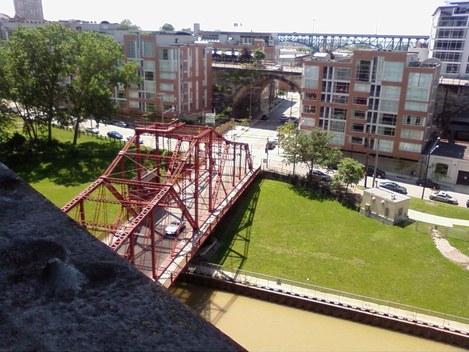
| Description | The Center Street Swing Bridge and the Stonebridge Condominiums, as seen from the lower deck of the Detroit-Superior Bridge, in Cleveland, Ohio. | ||
| Date | |||
| Source | originally posted to Flickr as Tyger0290 | ||
| Author | tygerdsebat | ||
| Permission (Reusing this file) |
This file is licensed under the Creative Commons Attribution-Share Alike 2.0 Generic license.
|
| Object location | | View this and other nearby images on: OpenStreetMap |
|---|
File history
Click on a date/time to view the file as it appeared at that time.
| Date/Time | Thumbnail | Dimensions | User | Comment | |
|---|---|---|---|---|---|
| current | 06:26, 17 October 2017 | | 1,600 × 1,200 (404 KB) | VortBot (talk | contribs) | Uploading higher resolution from Flickr |
| 00:05, 6 July 2008 |  | 1,024 × 768 (493 KB) | Flickr upload bot (talk | contribs) | Uploaded from http://flickr.com/photo/40422484@N00/2640449010 using Flickr upload bot |
You cannot overwrite this file.
File usage on Commons
The following page uses this file:
- File:Swing bridge.jpg (file redirect)