File:Celje location map.png

Original file (1,827 × 2,140 pixels, file size: 1.96 MB, MIME type: image/png)
Captions
Captions
Summary
[edit]
| Description |
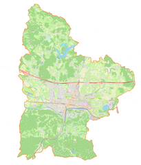
English: Location map |
| Date | |
| Source | Own work |
| Author | Smat |
| Description |
Polski: Mapa Celje, Słowenia
English: Map of Celje, Slovenia |
|||||||||
| Date | ||||||||||
| Source | You may find a page on the OpenStreetMap wiki page for Celje | |||||||||
| Creator |
OpenStreetMap contributors OpenStreetMap contributors |
|||||||||
| Permission (Reusing this file) |
OpenStreetMap data is available under the Open Database License (details). Standard style map tiles are licensed as ODbL Produced Works.
|
|||||||||
| Geotemporal data | ||||||||||
| Bounding box |
|
|||||||||
| Georeferencing | If inappropriate please set warp_status = skip to hide. | |||||||||
Licensing
[edit]
| This work contains information from OpenStreetMap, which is made available under the Open Database License (ODbL).
The ODbL does not require any particular license for maps produced from ODbL data. Prior to 1 August 2020, map tiles produced by the OpenStreetMap Foundation were licensed under the CC-BY-SA-2.0 license. Maps produced by other people may be subject to other licences. |
File history
Click on a date/time to view the file as it appeared at that time.
| Date/Time | Thumbnail | Dimensions | User | Comment | |
|---|---|---|---|---|---|
| current | 18:39, 18 August 2022 | | 1,827 × 2,140 (1.96 MB) | Smat (talk | contribs) | Uploaded own work with UploadWizard |
You cannot overwrite this file.
File usage on Commons
The following 2 pages use this file:
File usage on other wikis
The following other wikis use this file:
- Usage on pl.wikipedia.org
- Celje
- Katedra Świętego Daniela w Celju
- Diecezja Celje
- Port lotniczy Celje-Levec
- Celje (stacja kolejowa)
- Stadion Skalna klet
- Stadion Z’dežele
- Zamek Cylejski
- Dvorana Zlatorog
- Brezova (Słowenia)
- Bukovžlak
- Dobrova (gmina Celje)
- Glinsko
- Gorica pri Šmartnem
- Jezerce pri Šmartnem
- Košnica pri Celju
- Lahovna
- Leskovec (gmina Celje)
- Lipovec pri Škofji vasi
- Ljubečna
- Lokrovec
- Medlog
- Osenca
- Otemna
- Pepelno
- Prekorje
- Rožni Vrh (gmina Celje)
- Runtole
- Loče (gmina Celje)
- Pečovnik
- Slance
- Slatina v Rožni Dolini
- Rupe (gmina Celje)
- Teharje
- Tremerje
- Trnovlje pri Celju
- Vrhe (gmina Celje)
- Zadobrova
- Zvodno
- Začret
- Žepina
- Šentjungert
- Škofja vas
- Šmarjeta pri Celju
- Šmartno v Rožni Dolini
- Šmiklavž pri Škofji vasi
- Lopata (gmina Celje)
- Igrišče Glazija
- Atletski stadion Kladivar
- Moduł:Mapa/dane/Gmina miejska Celje
View more global usage of this file.