File:Cekakak Tunggir putih.jpg
Original file (2,124 × 1,407 pixels, file size: 1.01 MB, MIME type: image/jpeg)
Captions
Summary
[edit]DescriptionCekakak Tunggir putih.jpg |
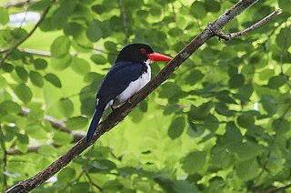
Bahasa Indonesia: cekakak tunggir putih merupakan salah satu jenis endemik yang ada di wilayah nusa tenggara / sunda kecil, persebaran yang terbatas ini menjadikan jenis ini masuk dalam UU perlindungan Satwa |
Date | Taken on 14 January 2018, 11:39:39 |
Source | Own work |
Author | Gizan hila |
Camera location | 8° 29′ 28.63″ S, 118° 32′ 02.45″ E | View this and other nearby images on: OpenStreetMap | -8.491287; 118.534014 |
---|
Licensing
[edit]- You are free:
- to share – to copy, distribute and transmit the work
- to remix – to adapt the work
- Under the following conditions:
- attribution – You must give appropriate credit, provide a link to the license, and indicate if changes were made. You may do so in any reasonable manner, but not in any way that suggests the licensor endorses you or your use.
- share alike – If you remix, transform, or build upon the material, you must distribute your contributions under the same or compatible license as the original.
This image was uploaded as part of Wiki Loves Earth 2020.
aragonés ∙ العربية ∙ asturianu ∙ azərbaycanca ∙ беларуская (тарашкевіца) ∙ български ∙ বাংলা ∙ brezhoneg ∙ català ∙ čeština ∙ Cymraeg ∙ Deutsch ∙ Ελληνικά ∙ English ∙ español ∙ eesti ∙ euskara ∙ فارسی ∙ français ∙ galego ∙ עברית ∙ hrvatski ∙ հայերեն ∙ Bahasa Indonesia ∙ italiano ∙ 日本語 ∙ ქართული ∙ 한국어 ∙ latviešu ∙ македонски ∙ മലയാളം ∙ मराठी ∙ Bahasa Melayu ∙ norsk bokmål ∙ नेपाली ∙ Nederlands ∙ norsk ∙ polski ∙ português ∙ português do Brasil ∙ română ∙ русский ∙ sicilianu ∙ shqip ∙ slovenščina ∙ српски / srpski ∙ svenska ∙ ไทย ∙ Türkçe ∙ українська ∙ اردو ∙ 简体中文 ∙ 繁體中文 ∙ +/− |
File history
Click on a date/time to view the file as it appeared at that time.
Date/Time | Thumbnail | Dimensions | User | Comment | |
---|---|---|---|---|---|
current | 04:51, 21 May 2020 | 2,124 × 1,407 (1.01 MB) | Gizanhila (talk | contribs) | Uploaded own work with UploadWizard |
You cannot overwrite this file.
File usage on Commons
The following page uses this file:
Metadata
This file contains additional information such as Exif metadata which may have been added by the digital camera, scanner, or software program used to create or digitize it. If the file has been modified from its original state, some details such as the timestamp may not fully reflect those of the original file. The timestamp is only as accurate as the clock in the camera, and it may be completely wrong.
Camera manufacturer | SONY |
---|---|
Camera model | SLT-A65V |
Exposure time | 1/15 sec (0.066666666666667) |
F-number | f/9 |
ISO speed rating | 400 |
Date and time of data generation | 11:39, 14 January 2018 |
Lens focal length | 400 mm |
Orientation | Normal |
Horizontal resolution | 300 dpi |
Vertical resolution | 300 dpi |
Software used | Adobe Photoshop CS6 (Windows) |
File change date and time | 23:50, 14 January 2018 |
Exposure Program | Manual |
Exif version | 2.3 |
Date and time of digitizing | 11:39, 14 January 2018 |
APEX shutter speed | 3.906891 |
APEX aperture | 6.33985 |
APEX brightness | 2.9546875 |
APEX exposure bias | 0 |
Maximum land aperture | 4.96875 APEX (f/5.6) |
Metering mode | Pattern |
Light source | Unknown |
Flash | Flash did not fire, compulsory flash suppression |
Color space | Uncalibrated |
File source | Digital still camera |
Scene type | A directly photographed image |
Custom image processing | Normal process |
Exposure mode | Manual exposure |
White balance | Auto white balance |
Focal length in 35 mm film | 1,200 mm |
Scene capture type | Standard |
Contrast | Hard |
Saturation | High saturation |
Sharpness | Hard |
Receiver status | Measurement interoperability |
Geodetic survey data used | WGS-84 |
GPS differential correction | 0 |
Lens used | 70-400mm F4-5.6 G SSM |
Rating (out of 5) | 0 |
Date metadata was last modified | 07:50, 15 January 2018 |
Unique ID of original document | D7C9910F3EEACAE215A587800CF05BAB |
IIM version | 2,484 |
Structured data
Items portrayed in this file
depicts
14 January 2018
8°29'28.633"S, 118°32'2.450"E
0.06666666666666666666 second
400 millimetre
400
image/jpeg
a94a73a356be29a94331de2b29aeb6cdc319b2dc
1,057,309 byte
1,407 pixel
2,124 pixel
- Indonesia photographs taken on 2018-01-14
- Files with coordinates missing SDC location of creation
- CC-BY-SA-4.0
- Self-published work
- Images from Wiki Loves Earth 2020
- Images from Wiki Loves Earth 2020 in Indonesia
- Images from Wiki Loves Earth missing SDC location of creation
- Uploaded via Campaign:wle-id
- Selected by WCA20 committee phase 1
- Selected by WCA20 committee phase 2