File:Catlin Covered Bridge.jpg
Jump to navigation
Jump to search

Size of this preview: 800 × 600 pixels. Other resolutions: 320 × 240 pixels | 640 × 480 pixels | 1,024 × 768 pixels | 1,280 × 960 pixels | 2,560 × 1,920 pixels | 2,816 × 2,112 pixels.
Original file (2,816 × 2,112 pixels, file size: 1.62 MB, MIME type: image/jpeg)
Captions
Captions
Add a one-line explanation of what this file represents
|
This is an image of a place or building that is listed on the National Register of Historic Places in the United States of America. Its reference number is 78000387. |
| Camera location | | View this and other nearby images on: OpenStreetMap |
|---|
| Description |
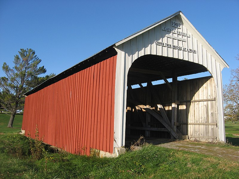
English: Southern portal and western side of the Catlin Covered Bridge, located off U.S. Route 36 on the grounds of the Parke County Golf Course in Adams Township, Parke County, Indiana, United States. Built in 1907 and moved to its present location in the 1960s, it is listed on the National Register of Historic Places. |
||
| Date | Taken on 15 October 2012 | ||
| Source | Own work | ||
| Author | Nyttend | ||
| Permission (Reusing this file) |
|
File history
Click on a date/time to view the file as it appeared at that time.
| Date/Time | Thumbnail | Dimensions | User | Comment | |
|---|---|---|---|---|---|
| current | 20:05, 17 October 2012 | | 2,816 × 2,112 (1.62 MB) | Nyttend (talk | contribs) | {{NRHP|78000387}} {{Location|39|47|30|N|87|14|18|W}} {{Information |Description={{en|Southern portal and western side of the {{w|Catlin Covered Bridge}}, located off {{w|U.S. Route 36}} on the grounds of the Parke County Golf Course in {{w|Adams Townsh... |
You cannot overwrite this file.
File usage on Commons
The following page uses this file:
File usage on other wikis
The following other wikis use this file:
- Usage on en.wikipedia.org
- Usage on es.wikipedia.org
- Usage on eu.wikipedia.org
- Usage on fa.wikipedia.org
- Usage on ur.wikipedia.org
- Usage on vi.wikipedia.org
- Usage on www.wikidata.org
- Usage on zh.wikipedia.org