File:Cartouche of an Ottoman map by Danckert.jpg
Jump to navigation
Jump to search
Size of this preview: 800 × 583 pixels. Other resolutions: 320 × 233 pixels | 640 × 466 pixels | 1,024 × 746 pixels | 1,280 × 933 pixels | 2,560 × 1,866 pixels | 2,928 × 2,134 pixels.
Original file (2,928 × 2,134 pixels, file size: 1.92 MB, MIME type: image/jpeg)
Captions
Captions
Add a one-line explanation of what this file represents
Summary
[edit]| Description |
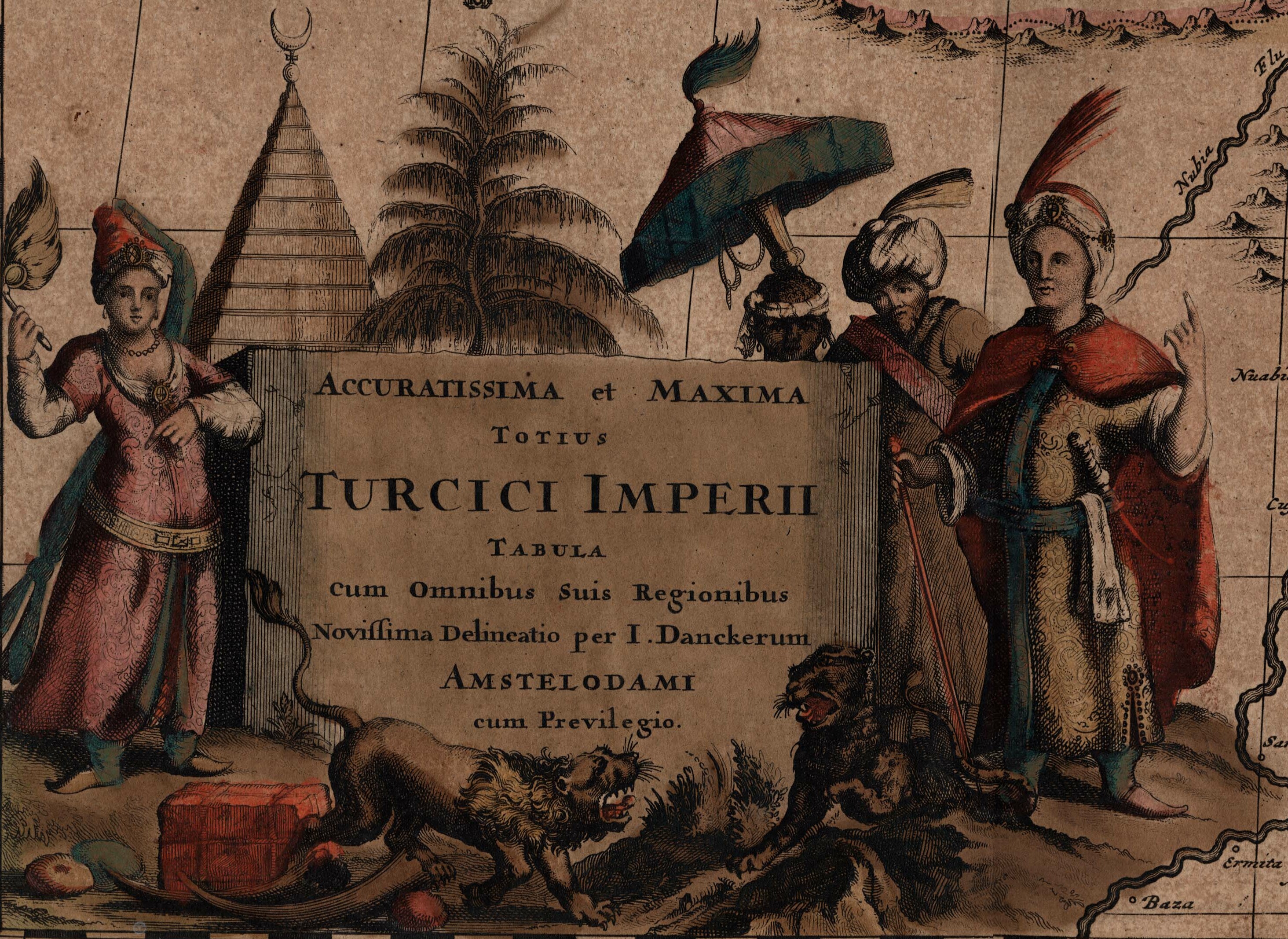
English: A map of Turkish possessions including Egypt and Greece by Justus Danckerts (1635-1701) shows the Arabian peninsula in the center. A decorative cartouche adorned with several costumed figures, a pyramid, and lions. Amsterdam. 52 x 62cm. |
| Date | |
| Source |
29. Accuratissine et Maxima Totius Turcici Imperii Tabula cum Omnibus suis Regionibus Novissima Delineatio // Mitchell King atlas (1662-1695)
|
| Author | Justus Danckerts (1635-1701) |
| Other versions |

Licensing
[edit]
|
This is a faithful photographic reproduction of a two-dimensional, public domain work of art. The work of art itself is in the public domain for the following reason:
The official position taken by the Wikimedia Foundation is that "faithful reproductions of two-dimensional public domain works of art are public domain".
This photographic reproduction is therefore also considered to be in the public domain in the United States. In other jurisdictions, re-use of this content may be restricted; see Reuse of PD-Art photographs for details. | ||||
| Annotations | This image is annotated: View the annotations at Commons |
File history
Click on a date/time to view the file as it appeared at that time.
| Date/Time | Thumbnail | Dimensions | User | Comment | |
|---|---|---|---|---|---|
| current | 14:54, 23 November 2022 | | 2,928 × 2,134 (1.92 MB) | Enyavar (talk | contribs) | File:Accuratissima et Maxima Totius Turcici Imperii Tabula.jpg cropped 67 % horizontally, 71 % vertically using CropTool with precise mode. |
You cannot overwrite this file.
File usage on Commons
The following page uses this file: