File:Cartouche in a map of russian Poland and Ukraine by Facius.jpg
Jump to navigation
Jump to search

Size of this preview: 800 × 399 pixels. Other resolutions: 320 × 160 pixels | 640 × 320 pixels | 1,024 × 511 pixels | 1,280 × 639 pixels | 3,126 × 1,561 pixels.
Original file (3,126 × 1,561 pixels, file size: 1,011 KB, MIME type: image/jpeg)
Captions
Captions
Add a one-line explanation of what this file represents
Summary
[edit]| Warning | The original file is very high-resolution. It might not load properly or could cause your browser to freeze when opened at full size. |
|---|
| Description |
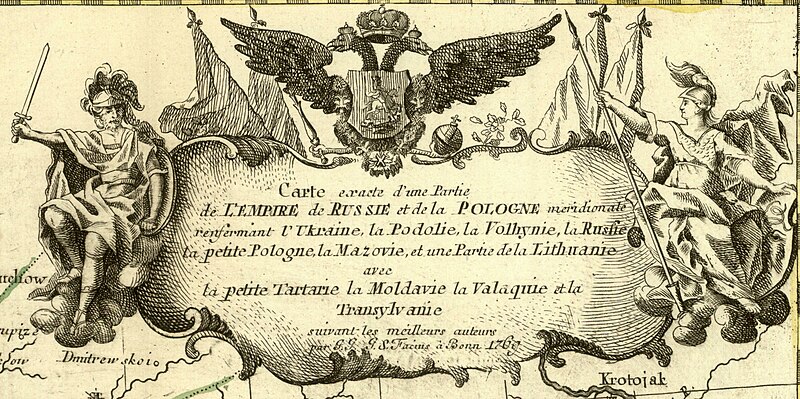
English: 1769 map of Poland and Russia in Europe by Johann Gottlieb Facius
Français : Carte exacte d'une Partie de l'Empire de Russie et de la Pologne meridionale renfermant l'Ukraine, la Podolie, la Volhynie, la Russie, la petite Pologne, la Mazovie, et une Partie de la Lithuanie avec la petite Tartarie la Moldavie la Valaquie et la Transylvanie suivant les meilleurs auteurs / par G.G., G.S. Facius à Bonn |
|||||||||||||||||||||||
| Date | ||||||||||||||||||||||||
| Source | https://mapy.mzk.cz/de/mzk03/001/053/427/2619316891/ | |||||||||||||||||||||||
| Author |
|
|||||||||||||||||||||||
| Other versions | 1769 map of Poland and Russia in Europe (Facius) 1.jpg (cropped) | |||||||||||||||||||||||


_1.jpg)
Licensing
[edit]
|
This work is in the public domain in its country of origin and other countries and areas where the copyright term is the author's life plus 100 years or fewer. This work is in the public domain in the United States because it was published (or registered with the U.S. Copyright Office) before January 1, 1929. | |
| This file has been identified as being free of known restrictions under copyright law, including all related and neighboring rights. | |
File history
Click on a date/time to view the file as it appeared at that time.
| Date/Time | Thumbnail | Dimensions | User | Comment | |
|---|---|---|---|---|---|
| current | 19:11, 22 November 2023 | | 3,126 × 1,561 (1,011 KB) | Enyavar (talk | contribs) | File:1769 map of Poland and Russia in Europe by Johann Gottlieb Facius.jpg cropped 73 % horizontally, 80 % vertically using CropTool with precise mode. |
You cannot overwrite this file.
File usage on Commons
The following page uses this file: