File:Cartouche in a map of Astrakhan.jpg
Jump to navigation
Jump to search

Size of this preview: 526 × 599 pixels. Other resolutions: 211 × 240 pixels | 421 × 480 pixels | 747 × 851 pixels.
Original file (747 × 851 pixels, file size: 118 KB, MIME type: image/jpeg)
Captions
Captions
Add a one-line explanation of what this file represents
Summary
[edit]| Description |
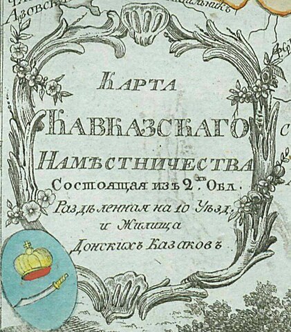
Русский: Малоформатный атлас Российской империи (1792). Карта 1-го Кавказского наместничества и земель Донских казаков(карта 42).
English: Small atlas of the Russian Empire (1792). Map of 1st Caucasus Viceroyalty (Namestnichestvo) and Don Voisko (map 42). |
| Date | |
| Source |
Русский: Атлас Российской империи, : Состоящий из 46 карт, : Изданный во граде св. Петра 1792 года / отпечатан не ранее 1793 года. Цифровая копия сделана Российской государственной библиотекой (http://www.rsl.ru)
English: Atlas of the Russian Empire (1792), : Consist of 46 maps, : Published in St. Petersburg (1792) / printed in 1793 or later. Digital copy made by Russian State Library (http://www.rsl.ru/en) |
| Author |
Русский: издатель: типография Сытина
English: publisher:Sytin's print shop |
| Other versions |
|
.jpg)
.jpg)
Licensing
[edit]
|
This work is in the public domain in its country of origin and other countries and areas where the copyright term is the author's life plus 100 years or fewer. | |
| This file has been identified as being free of known restrictions under copyright law, including all related and neighboring rights. | |
File history
Click on a date/time to view the file as it appeared at that time.
| Date/Time | Thumbnail | Dimensions | User | Comment | |
|---|---|---|---|---|---|
| current | 00:23, 7 January 2023 | | 747 × 851 (118 KB) | Enyavar (talk | contribs) | File:Map of Caucasus Namestnichestvo 1792 (small atlas).jpg cropped 72 % horizontally, 62 % vertically using CropTool with precise mode. |
You cannot overwrite this file.
File usage on Commons
The following page uses this file: