File:Cartouche in a France map by Bonne.jpg
Jump to navigation
Jump to search
Size of this preview: 485 × 600 pixels. Other resolutions: 194 × 240 pixels | 388 × 480 pixels | 737 × 911 pixels.
Original file (737 × 911 pixels, file size: 223 KB, MIME type: image/jpeg)
Captions
Captions
Add a one-line explanation of what this file represents
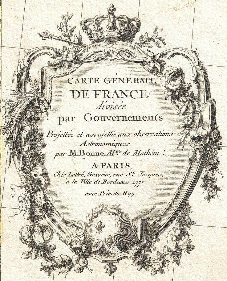
| Rigobert Bonne: Carte Generale de France divisee par Gouvernements.
( |
|||||||||||||||||||||||
|---|---|---|---|---|---|---|---|---|---|---|---|---|---|---|---|---|---|---|---|---|---|---|---|
| Artist |
|
||||||||||||||||||||||
| Title |
Carte Generale de France divisee par Gouvernements. |
||||||||||||||||||||||
| Description |
English: A beautiful example of Rigobert Bonne's decorative map of France. Covers the entirety of France from Spain to Germany and from the British Channel to the Mediterranean. Divided into provinces with color coding according to region. Offers excellent detail throughout showing mountains, rivers, forests, national boundaries, regional boundaries, forts, and cities. A large decorative title cartouche appears in the lower left quadrant. Drawn by Rigobert Bonne in 1771 for issue as plate no. 4 in Jean Lattre's 1776 edition of the Atlas Moderne . |
||||||||||||||||||||||
| Date | 1771 (dated) | ||||||||||||||||||||||
| Dimensions | height: 12 in (30.4 cm); width: 16.5 in (41.9 cm) | ||||||||||||||||||||||
| Accession number |
Geographicus link: FranceGov-bonne-1771 |
||||||||||||||||||||||
| Source/Photographer |
Lattre, Jean, Atlas Moderne ou Collection de Cartes sur Toutes les Parties du Globe Terrestre, c. 1775.
|
||||||||||||||||||||||
| Permission (Reusing this file) |
|
||||||||||||||||||||||
| Other versions | |||||||||||||||||||||||

File history
Click on a date/time to view the file as it appeared at that time.
| Date/Time | Thumbnail | Dimensions | User | Comment | |
|---|---|---|---|---|---|
| current | 14:40, 3 December 2022 | | 737 × 911 (223 KB) | Enyavar (talk | contribs) | File:1771 Bonne Map of France - Geographicus - FranceGov-bonne-1771.jpg cropped 79 % horizontally, 64 % vertically using CropTool with lossless mode. |
You cannot overwrite this file.
File usage on Commons
The following 2 pages use this file: