File:Cartes topographiques en 2 flles des environs de Nice, Villefranche, Menton et Vintimille - btv1b53167624n (1 of 2).jpg
Jump to navigation
Jump to search

Size of this preview: 800 × 543 pixels. Other resolutions: 320 × 217 pixels | 640 × 434 pixels | 1,024 × 695 pixels | 1,280 × 868 pixels | 2,560 × 1,736 pixels | 12,882 × 8,738 pixels.
Original file (12,882 × 8,738 pixels, file size: 14.24 MB, MIME type: image/jpeg)
Captions
Captions
Add a one-line explanation of what this file represents
Summary
[edit]| Warning | The original file is very high-resolution. It might not load properly or could cause your browser to freeze when opened at full size. |
|---|
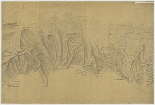
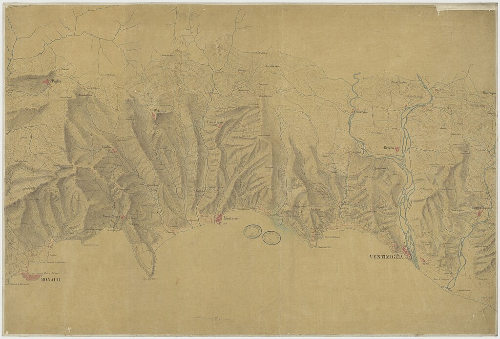
| Cartes topographiques en 2 flles des environs de Nice, Villefranche, Menton et Vintimille
( |
|||||||||||||||||||||||||||
|---|---|---|---|---|---|---|---|---|---|---|---|---|---|---|---|---|---|---|---|---|---|---|---|---|---|---|---|
| Title |
Cartes topographiques en 2 flles des environs de Nice, Villefranche, Menton et Vintimille |
||||||||||||||||||||||||||
| Description |
Français : Sujet : Côtes
Alpes-de-Haute-Provence, Département des Ligurie, Région Échelle(s) : [Echelle non mentionnée] Couverture : France – Provence-Alpes-Côte-d'Azur – Alpes-de-Haute-Provence Italie – Ligurie Langue : italien |
||||||||||||||||||||||||||
| Date | 19th century | ||||||||||||||||||||||||||
| Collection |
|
||||||||||||||||||||||||||
| References |
Français : Notice de recueil : http://catalogue.bnf.fr/ark:/12148/cb44525794m
Appartient à : [Division 10 BIS du portefeuille 1 QUATER du Service hydrographique de la marine consacrée à la France] ; 2 l Notice du catalogue : http://catalogue.bnf.fr/ark:/12148/cb454579529 |
||||||||||||||||||||||||||
| Source/Photographer |
Français : Bibliothèque nationale de France, département Cartes et plans, GE SH 19 PF 1 QUATER DIV 10 BIS P 2 l
Bibliothèque nationale de France (1/2) |
||||||||||||||||||||||||||
| Permission (Reusing this file) |
|
||||||||||||||||||||||||||

.jpg&action=edit§ion=1)
.jpg&flash=no)
File history
Click on a date/time to view the file as it appeared at that time.
| Date/Time | Thumbnail | Dimensions | User | Comment | |
|---|---|---|---|---|---|
| current | 01:55, 14 July 2022 | | 12,882 × 8,738 (14.24 MB) | Gzen92Bot (talk | contribs) | Gallica btv1b53167624n |
You cannot overwrite this file.
File usage on Commons
The following page uses this file:
.jpg)
.jpg&oldid=849393302)