File:Carter Falls Trailhead Wayside (ea839768-5d14-4e05-811a-5bf227aa9df9).JPG
Jump to navigation
Jump to search
Size of this preview: 450 × 600 pixels. Other resolutions: 180 × 240 pixels | 360 × 480 pixels | 576 × 768 pixels | 768 × 1,024 pixels | 1,536 × 2,048 pixels | 3,024 × 4,032 pixels.
Original file (3,024 × 4,032 pixels, file size: 4.44 MB, MIME type: image/jpeg)
Captions
Captions
Add a one-line explanation of what this file represents
| Camera location | | View this and other nearby images on: OpenStreetMap |
|---|
.JPG¶ms=046.766900_N_-121.790628_E_globe:Earth_type:camera_alt:973.75912_source:exif_heading:62.79&language=en)

|
The categories of this image need checking. You can do so here.
|
.JPG&action=edit&withJS=MediaWiki:Catcheck.js)
Summary
[edit].JPG&action=edit§ion=1)
| English: Carter Falls Trailhead Wayside | ||||
|---|---|---|---|---|
| Photographer |
English: NPS Photo |
|||
| Title |
English: Carter Falls Trailhead Wayside |
|||
| Description |
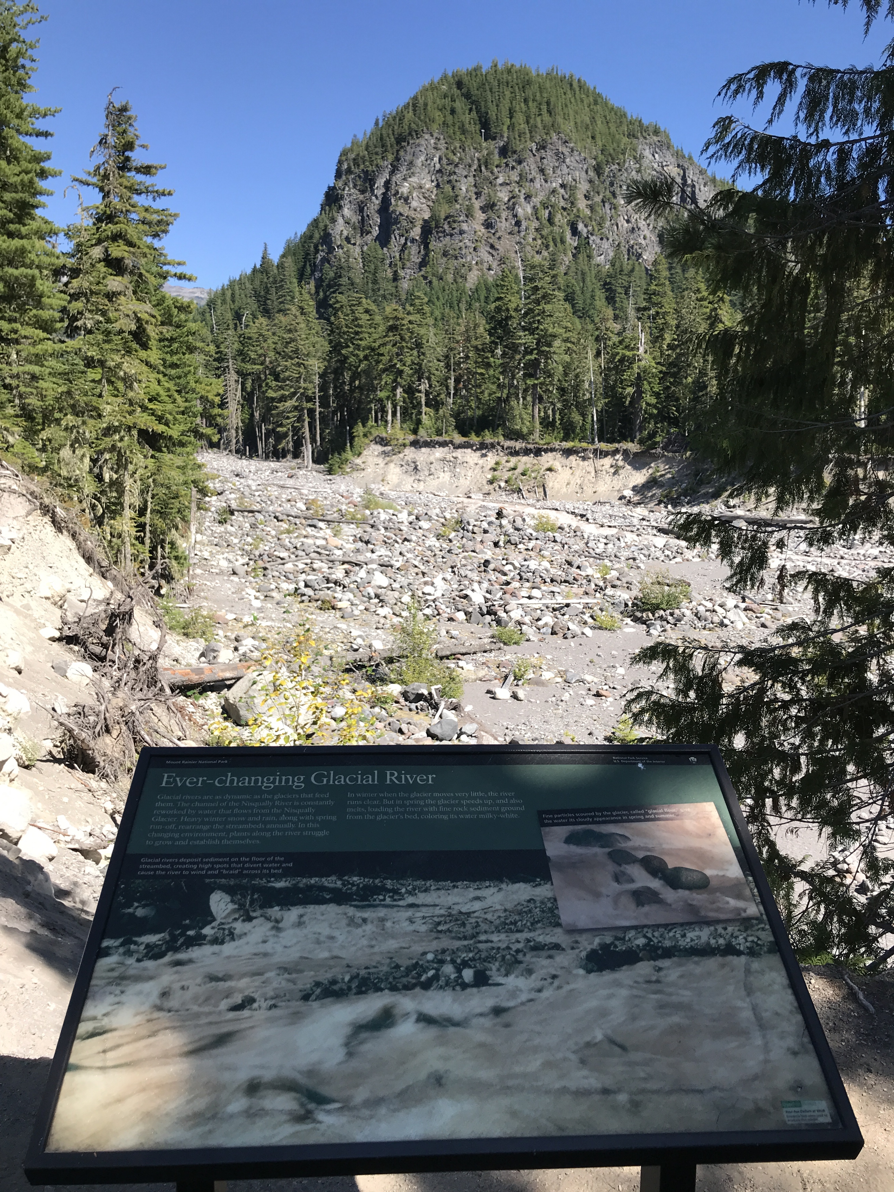
English: A wayside panel overlooks a wide rocky river bed, with steep eroding edges. A forested rocky hillside rises above the river on the opposite shore. The Carter Falls trailhead wayside is located near the Nisqually River along the section of the Wonderland Trail leading to Carter Falls.
|
|||
| Depicted place |
English: Mount Rainier National Park, Washington |
|||
| Date | Taken on 4 September 2019 | |||
| Accession number | ||||
| Source |
English: NPGallery |
|||
| Permission (Reusing this file) |
|
|||
| NPS Unit Code | MORA | |||
File history
Click on a date/time to view the file as it appeared at that time.
| Date/Time | Thumbnail | Dimensions | User | Comment | |
|---|---|---|---|---|---|
| current | 20:00, 16 January 2022 | | 3,024 × 4,032 (4.44 MB) | BMacZeroBot (talk | contribs) | Batch upload (Commons:Batch uploading/NPGallery) |
You cannot overwrite this file.
File usage on Commons
The following page uses this file:
.JPG)
.JPG&oldid=849371530)