File:Cartellkarte preWK1.jpg
Jump to navigation
Jump to search

Size of this preview: 712 × 600 pixels. Other resolutions: 285 × 240 pixels | 570 × 480 pixels | 951 × 801 pixels.
Original file (951 × 801 pixels, file size: 126 KB, MIME type: image/jpeg)
Captions
Captions
Add a one-line explanation of what this file represents
Summary
[edit]
| Description |
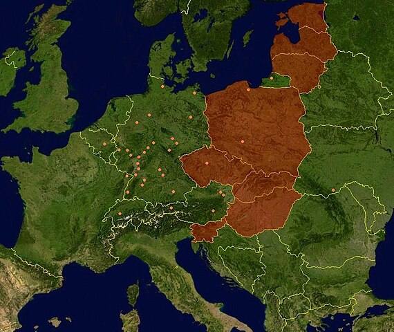
Deutsch: Die Verbindungen des Cartellverbandes der katholischen deutschen Studentenverbindungen (Stand bevor II. WK: 1932 (Satellitenbild Zentraleuropa; Estland, Lettland, Litauen, Polen, Ungarn, Tschechien, Slowakei, Slowenien, Malta und der griechische Teil Zyperns grafisch hervogehoben)
English: Countries that joined the European Union in May 2004. Satellite-map of Europe incl. borders with color overlay. |
| Date | 7 April 2006 (original upload date) |
| Source |
English: NASA World Wind (public domain), color-overlay by WLuef.
Deutsch: Erstellt mit NASA World Wind, Farbüberlagerung WLuef. |
| Author | The original uploader was Stijn Calle at German Wikipedia. |
| Permission (Reusing this file) |
Dieses Bild enthält Material, das ursprünglich von einer NASA-Webseite oder -Veröffentlichung stammt. Alle Informationen der NASA mit Ausnahme des NASA-Logos sind Public Domain. Siehe hierzu: NASA copyright policy |
Licensing
[edit]
| This image is in the public domain because it is a screenshot from NASA’s globe software World Wind using a public domain layer, such as Blue Marble, MODIS, Landsat, SRTM, USGS or GLOBE.
|
 |
Original upload log
[edit]
Transferred from de.wikipedia to Commons by Akkakk.
The original description page was here. All following user names refer to de.wikipedia.
- 2006-04-07 16:48 Stijn Calle 951×801× (129017 bytes) Beschreibung: Die Verbindungen des Cartellverbandes der katholischen deutschen Studentenverbindungen (Stand bevor II. WK: 1932 (Satellitenbild Zentraleuropa; Estland, Lettland, Litauen, Polen, Ungarn, Tschechien, Slowakei, Slowenien, Malta und der griechi
File history
Click on a date/time to view the file as it appeared at that time.
| Date/Time | Thumbnail | Dimensions | User | Comment | |
|---|---|---|---|---|---|
| current | 20:32, 9 July 2011 | | 951 × 801 (126 KB) | Akkakk (talk | contribs) | {{Information |Description={{de|Die Verbindungen des Cartellverbandes der katholischen deutschen Studentenverbindungen (Stand bevor II. WK: 1932 (Satellitenbild Zentraleuropa; Estland, Lettland, Litauen, Polen, Ungarn, Tschechien, Slowakei, Slowenien, Mal |
You cannot overwrite this file.
File usage on Commons
There are no pages that use this file.