File:Carte postale - Puteaux - Les Ecoles de la Rue de Paris - 9FI-PUT 66.jpg
Jump to navigation
Jump to search
Size of this preview: 800 × 541 pixels. Other resolutions: 320 × 216 pixels | 640 × 432 pixels | 1,024 × 692 pixels | 1,280 × 865 pixels | 2,560 × 1,730 pixels | 3,537 × 2,390 pixels.
Original file (3,537 × 2,390 pixels, file size: 1.09 MB, MIME type: image/jpeg)
Captions
Captions
Add a one-line explanation of what this file represents
Summary
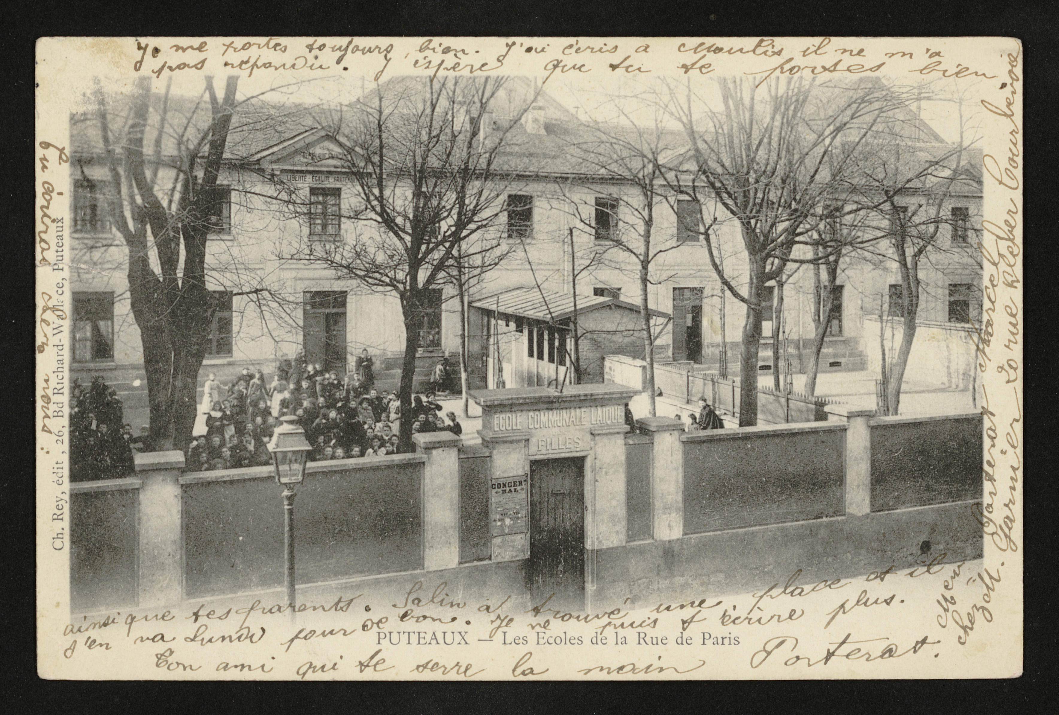
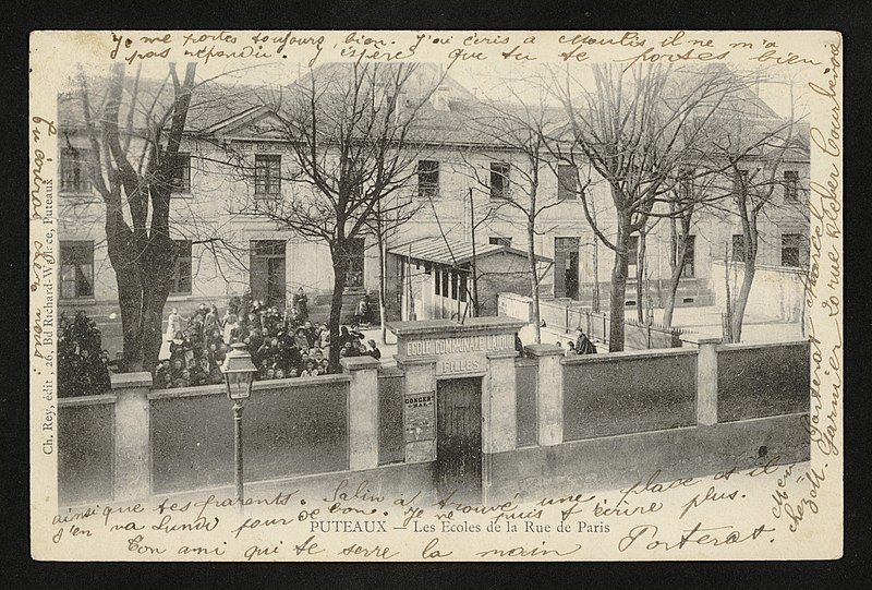
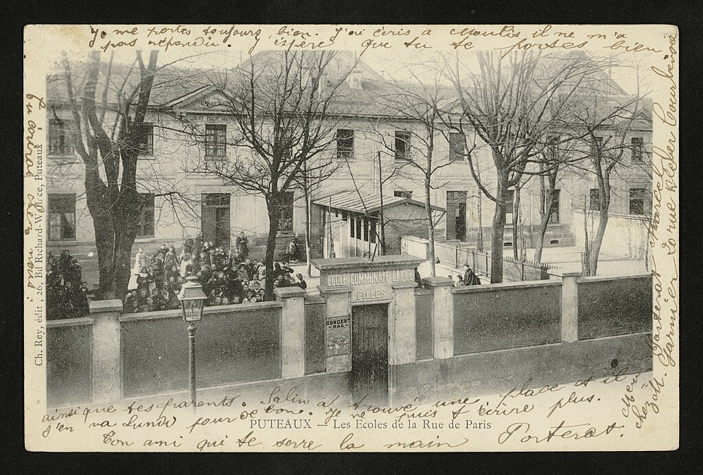
[edit]| Français : Carte postale des Hauts-de-Seine
( |
|
|---|---|
| Photographer |
Unknown author |
| Title |
Français : Carte postale des Hauts-de-Seine |
| Description |
Français : Les Ecoles de la Rue de Paris |
| Date | 1900 |
| Collection | |
| Accession number |
9FI/PUT_66 |
| Source | https://opendata.hauts-de-seine.fr/explore/dataset/cartes-postales/information/ |

| Object location | | View this and other nearby images on: OpenStreetMap |
|---|
Licensing
[edit]
| This file is licensed under the Licence Ouverte 1.0 (License text, English license text).
|
File history
Click on a date/time to view the file as it appeared at that time.
| Date/Time | Thumbnail | Dimensions | User | Comment | |
|---|---|---|---|---|---|
| current | 21:04, 11 October 2020 | | 3,537 × 2,390 (1.09 MB) | Pyb (talk | contribs) | pattypan 20.04 |
You cannot overwrite this file.
File usage on Commons
The following 2 pages use this file: