File:Carte générale de la partie française de l'isle de St. Domingue. LOC 74692178.jpg
Jump to navigation
Jump to search

Size of this preview: 800 × 566 pixels. Other resolutions: 320 × 226 pixels | 640 × 453 pixels | 1,024 × 725 pixels | 1,280 × 906 pixels | 2,560 × 1,812 pixels | 14,917 × 10,558 pixels.
Original file (14,917 × 10,558 pixels, file size: 16.36 MB, MIME type: image/jpeg)
Captions
Captions
Add a one-line explanation of what this file represents
Summary
[edit]| Warning | The original file is very high-resolution. It might not load properly or could cause your browser to freeze when opened at full size. |
|---|
| Description |
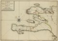
English: Scale ca. 1:350,000. Manuscript, pen-and-ink and watercolor. Has watermark. Relief shown by shading. Depths shown by soundings. LC Luso-Hispanic World, 451 LC Maps of North America, 1750-1789, 1869 Available also through the Library of Congress Web site as a raster image. Index map to coastal charts, with coastline divided into 50 sections. Vault AACR2 |
||
| Title | Carte générale de la partie française de l'isle de St. Domingue. | ||
| Shelf ID | G4940 1776 .C3 | ||
| Date | |||
| Source | https://www.loc.gov/item/74692178/ | ||
| Author | Unknown author | ||
| Permission (Reusing this file) |
|
||
| Other versions |
|
||
| Location | Haiti | ||
| Part of | Cultural Landscapes · Military Battles And Campaigns · Catalog · American Memory · Geography And Map Division · American Revolution And Its Era: Maps And Charts Of North America And The West Indies, 1750-1789 | ||
| Subject | Index Maps · Nautical Charts · Early Maps · Maps · Early Works To 1800 · Haiti · Manuscript Maps |

Licensing
[edit]
|
This is a faithful photographic reproduction of a two-dimensional, public domain work of art. The work of art itself is in the public domain for the following reason:
The official position taken by the Wikimedia Foundation is that "faithful reproductions of two-dimensional public domain works of art are public domain".
This photographic reproduction is therefore also considered to be in the public domain in the United States. In other jurisdictions, re-use of this content may be restricted; see Reuse of PD-Art photographs for details. | ||||
File history
Click on a date/time to view the file as it appeared at that time.
| Date/Time | Thumbnail | Dimensions | User | Comment | |
|---|---|---|---|---|---|
| current | 06:43, 8 June 2018 | | 14,917 × 10,558 (16.36 MB) | Fæ (talk | contribs) | LOC Maps https://www.loc.gov/item/74692178/ #23536 |
You cannot overwrite this file.
File usage on Commons
The following page uses this file: