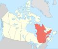
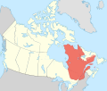
File:Carte du Québec au sein du Canada.svg
From Wikimedia Commons, the free media repository
Jump to navigation
Jump to search

Size of this PNG preview of this SVG file: 707 × 600 pixels. Other resolutions: 283 × 240 pixels | 566 × 480 pixels | 905 × 768 pixels | 1,207 × 1,024 pixels | 2,414 × 2,048 pixels | 1,083 × 919 pixels.
Original file (SVG file, nominally 1,083 × 919 pixels, file size: 80 KB)
File information
Structured data
Captions
Captions
Add a one-line explanation of what this file represents
Summary
[edit]| DescriptionCarte du Québec au sein du Canada.svg | |
| Date | (UTC) |
| Source |
Own work. Source :
|
| Author | Sémhur (talk) |
| Other versions |
Derivative works of this file: |
| SVG development InfoField | |
| Attribution (required by the license) InfoField | © Sémhur / Wikimedia Commons / |
InfoField | © Sémhur / Wikimedia Commons |
| Camera location | 63° 00′ 00″ N, 88° 00′ 00″ W | View this and other nearby images on: OpenStreetMap |
|---|
This map was improved or created by the Wikigraphists of the Graphic Lab (fr). You can propose images to clean up, improve, create or translate as well. |
Licensing
[edit]I, the copyright holder of this work, hereby publish it under the following licenses:
| Copyleft: This work of art is free; you can redistribute it and/or modify it according to terms of the Free Art License. You will find a specimen of this license on the Copyleft Attitude site as well as on other sites. http://artlibre.org/licence/lal/enFALFree Art Licensefalsetrue |
This file is licensed under the Creative Commons Attribution-Share Alike 4.0 International, 3.0 Unported, 2.5 Generic, 2.0 Generic and 1.0 Generic license.
- You are free:
- to share – to copy, distribute and transmit the work
- to remix – to adapt the work
- Under the following conditions:
- attribution – You must give appropriate credit, provide a link to the license, and indicate if changes were made. You may do so in any reasonable manner, but not in any way that suggests the licensor endorses you or your use.
- share alike – If you remix, transform, or build upon the material, you must distribute your contributions under the same or compatible license as the original.
You may select the license of your choice.
File history
Click on a date/time to view the file as it appeared at that time.
| Date/Time | Thumbnail | Dimensions | User | Comment | |
|---|---|---|---|---|---|
| current | 17:09, 7 December 2014 |  | 1,083 × 919 (80 KB) | Sémhur (talk | contribs) | Valid SVG |
| 14:56, 8 December 2011 |  | 1,083 × 919 (80 KB) | Riba (talk | contribs) | Minor corrections of colors. | |
| 19:51, 27 September 2011 |  | 1,083 × 919 (75 KB) | Sémhur (talk | contribs) | == {{int:filedesc}} == {{Information |Description={{Multilingual description |en= Blank map showing en:Québec in Canada, in red, with the disputed area between Quebec and Labrador, in pink. |fr= Carte montrant le fr:Québec au sein du Canada, |
You cannot overwrite this file.
File usage on Commons
The following 2 pages use this file:
File usage on other wikis
The following other wikis use this file:
- Usage on af.wikipedia.org
- Usage on ang.wikipedia.org
- Usage on arc.wikipedia.org
- Usage on bat-smg.wikipedia.org
- Usage on co.wikipedia.org
- Usage on cr.wikipedia.org
- Usage on el.wikipedia.org
- Usage on el.wikivoyage.org
- Usage on eo.wikipedia.org
- Usage on eo.wikinews.org
- Usage on es.wikipedia.org
- Usage on et.wikipedia.org
- Usage on fiu-vro.wikipedia.org
- Usage on fo.wikipedia.org
- Usage on fr.wikipedia.org
- Usage on gag.wikipedia.org
- Usage on gl.wikipedia.org
- Usage on gv.wikipedia.org
- Usage on hak.wikipedia.org
- Usage on ha.wikipedia.org
- Usage on hy.wikipedia.org
- Usage on incubator.wikimedia.org
- Usage on it.wikivoyage.org
- Usage on ja.wikipedia.org
- Usage on ka.wikipedia.org
- Usage on kw.wikipedia.org
- Usage on lb.wikipedia.org
- Usage on lv.wikipedia.org
- Usage on mi.wikipedia.org
- Usage on nds-nl.wikipedia.org
- Usage on nrm.wikipedia.org
- Usage on pap.wikipedia.org
- Usage on pa.wikipedia.org
- Usage on pcd.wikipedia.org
- Usage on pl.wikipedia.org
- Usage on pt.wikipedia.org
- Usage on qu.wikipedia.org
- Usage on ro.wikipedia.org
- Usage on ru.wiktionary.org
- Usage on sco.wikipedia.org
- Usage on sl.wikipedia.org
- Usage on sr.wikipedia.org
- Usage on sv.wikipedia.org
View more global usage of this file.
Metadata
This file contains additional information such as Exif metadata which may have been added by the digital camera, scanner, or software program used to create or digitize it. If the file has been modified from its original state, some details such as the timestamp may not fully reflect those of the original file. The timestamp is only as accurate as the clock in the camera, and it may be completely wrong.
| Short title | Map of Quebec in Canada |
|---|---|
| Width | 1083 |
| Height | 919 |
Structured data
Elementos representados en este archivo
depicts
Algún valor sin elemento de Wikidata
27 September 2011
63°N, 88°W
image/svg+xml
31e7595e58ec4c6321f306bced2514dee2164d73
81,930 byte
919 pixel
1,083 pixel
Hidden categories: